File:Iosepa Monument.jpg
Original file (1,440 × 2,160 pixels, file size: 416 KB, MIME type: image/jpeg)
Captions
This is an image of a place or building that is listed on the National Register of Historic Places in the United States of America. Its reference number is 71000856. |
DescriptionIosepa Monument.jpg |
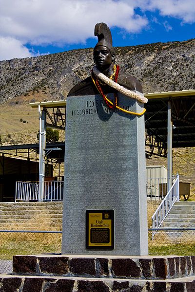
English: Monument overlooking Iosepa, Utah cemetery. Skull Valley, Utah. |
|||
Source | Own work | |||
Author | Ikeosaurus | |||
Permission (Reusing this file) |
|
Camera location | 40° 32′ 30.64″ N, 112° 44′ 00.08″ W | View this and other nearby images on: OpenStreetMap | 40.541844; -112.733356 |
---|
File history
Click on a date/time to view the file as it appeared at that time.
Date/Time | Thumbnail | Dimensions | User | Comment | |
---|---|---|---|---|---|
current | 06:31, 6 April 2009 | 1,440 × 2,160 (416 KB) | Ikeosaurus (talk | contribs) | {{Information |Description={{en|1=Monument overlooking Iosepa, Utah cemetery. Skull Valley, Utah.}} |Source=Own work by uploader |Author=Ikeosaurus |Date= |Permission= |other_versions= }} <!--{{ImageUpload|full}}--> |
You cannot overwrite this file.
File usage on Commons
There are no pages that use this file.
File usage on other wikis
The following other wikis use this file:
- Usage on en.wikipedia.org
Metadata
This file contains additional information such as Exif metadata which may have been added by the digital camera, scanner, or software program used to create or digitize it. If the file has been modified from its original state, some details such as the timestamp may not fully reflect those of the original file. The timestamp is only as accurate as the clock in the camera, and it may be completely wrong.
Camera manufacturer | Canon |
---|---|
Camera model | Canon EOS DIGITAL REBEL XSi |
Exposure time | 1/40 sec (0.025) |
F-number | f/22 |
ISO speed rating | 100 |
Date and time of data generation | 14:51, 5 April 2009 |
Lens focal length | 55 mm |
Latitude | 40° 32′ 30.64″ N |
Longitude | 112° 44′ 0.08″ W |
Altitude | 1,370.5 meters above sea level |
City shown | 1 km NE of Iosepa |
Orientation | Normal |
Horizontal resolution | 240 dpi |
Vertical resolution | 240 dpi |
Software used | Adobe Photoshop CS3 Macintosh |
File change date and time | 00:17, 6 April 2009 |
Exposure Program | Aperture priority |
Exif version | 2.21 |
Date and time of digitizing | 14:51, 5 April 2009 |
APEX shutter speed | 5.321928 |
APEX aperture | 8.918863 |
APEX exposure bias | 0 |
Maximum land aperture | 5 APEX (f/5.66) |
Metering mode | Pattern |
Flash | Flash did not fire, compulsory flash suppression |
DateTime subseconds | 03 |
DateTimeOriginal subseconds | 03 |
DateTimeDigitized subseconds | 03 |
Color space | Uncalibrated |
Focal plane X resolution | 4,865.6036446469 |
Focal plane Y resolution | 4,876.7123287671 |
Focal plane resolution unit | inches |
Custom image processing | Normal process |
Exposure mode | Auto exposure |
White balance | Auto white balance |
Scene capture type | Standard |
GPS time (atomic clock) | 20:50 |
Geodetic survey data used | WGS-84 |
GPS date | 5 April 2009 |
GPS tag version | 0.0.2.2 |
Image width | 1,440 px |
Image height | 2,160 px |
Serial number of camera | 1170313360 |
Lens used | EF-S18-55mm f/3.5-5.6 IS |
Rating (out of 5) | 0 |
Date metadata was last modified | 18:17, 5 April 2009 |
Province or state shown | Utah |
Country shown | United States |