File:Iranian-ethno-languages-map.png

Size of this preview: 800 × 542 pixels. Other resolutions: 320 × 217 pixels | 640 × 433 pixels | 1,024 × 693 pixels | 1,214 × 822 pixels.
Original file (1,214 × 822 pixels, file size: 63 KB, MIME type: image/png)
Captions
Captions
Add a one-line explanation of what this file represents

Summary edit
| Description |
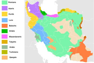
distribution of the languages and ethnic groups of Iran
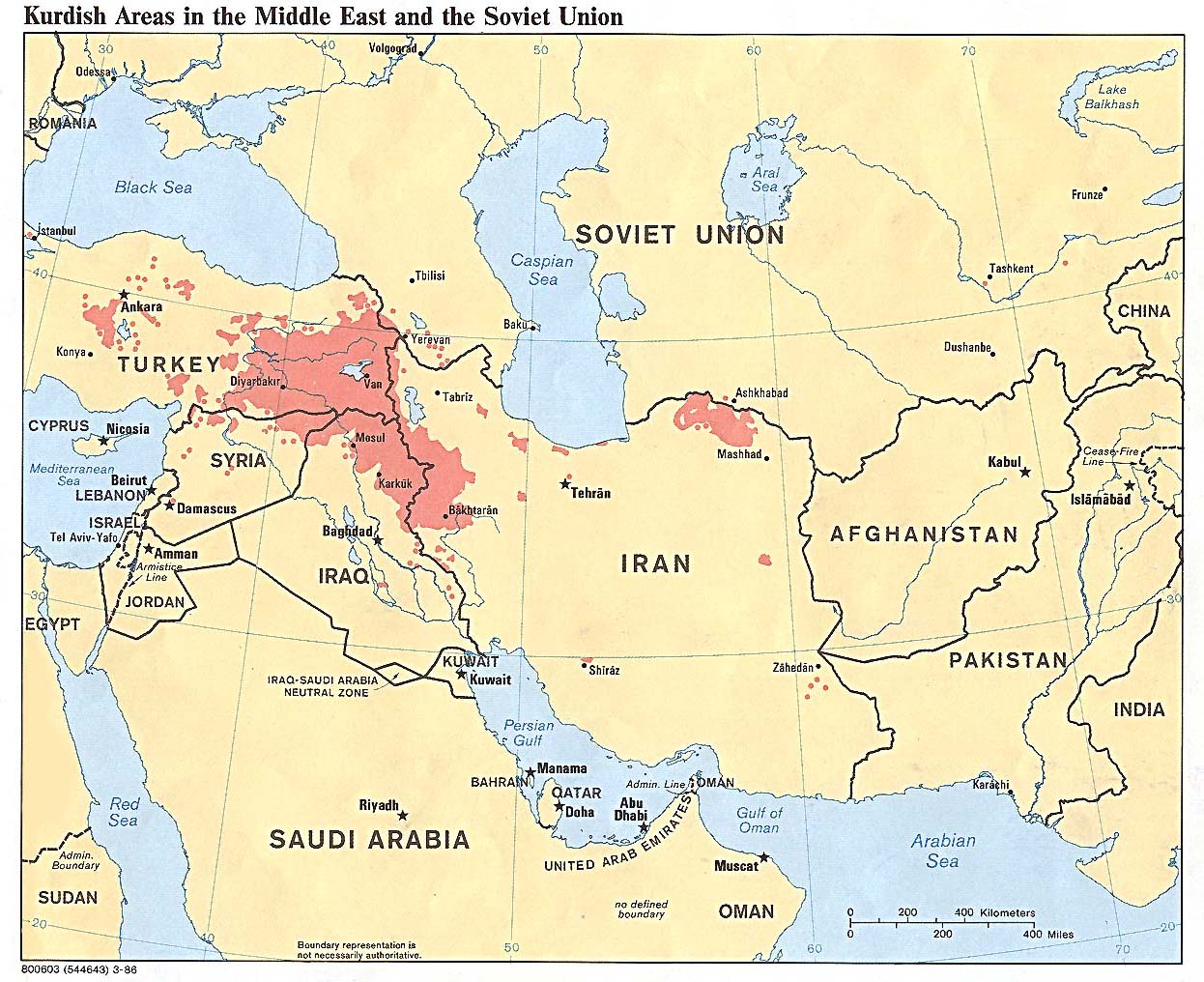
Previous map had many mistakes. i fixed them based on sources. http://www.geocurrents.info/wp-content/uploads/2013/07/Main-Ethnic-Languages-in-Iran-Map.png http://geocurrents.info/wp-content/uploads/2011/11/Parsa_Greater_Iran_Map.jpg http://www.lib.utexas.edu/maps/middle_east_and_asia/kurdish_86.jpg |
| Date | |
| Source | Own work |
| Author | Hosseiniran |
| Other versions |
|


Licensing edit
Hosseiniran at English Wikipedia, the copyright holder of this work, hereby publishes it under the following licenses:

|
Permission is granted to copy, distribute and/or modify this document under the terms of the GNU Free Documentation License, Version 1.2 or any later version published by the Free Software Foundation; with no Invariant Sections, no Front-Cover Texts, and no Back-Cover Texts. A copy of the license is included in the section entitled GNU Free Documentation License. |
This file is licensed under the Creative Commons Attribution-Share Alike 4.0 International license.
Attribution: Hosseiniran at English Wikipedia
- You are free:
- to share – to copy, distribute and transmit the work
- to remix – to adapt the work
- Under the following conditions:
- attribution – You must give appropriate credit, provide a link to the license, and indicate if changes were made. You may do so in any reasonable manner, but not in any way that suggests the licensor endorses you or your use.
- share alike – If you remix, transform, or build upon the material, you must distribute your contributions under the same or compatible license as the original.
You may select the license of your choice.
Original upload log edit
The original description page was here. All following user names refer to en.wikipedia.
| Date/Time | Dimensions | User | Comment |
|---|---|---|---|
| 2016-08-14 13:48 | 1214×822× (50067 bytes) | Beshogur | Update. |
| 2016-07-31 10:36 | 1214×822× (73924 bytes) | Hosseiniran | Uploading a self-made file using [[Wikipedia:File_Upload_Wizard|File Upload Wizard]] |
File history
Click on a date/time to view the file as it appeared at that time.
| Date/Time | Thumbnail | Dimensions | User | Comment | |
|---|---|---|---|---|---|
| current | 15:53, 3 August 2022 | | 1,214 × 822 (63 KB) | Eidiporia2 (talk | contribs) | Three different sources: https://en.wikipedia.org/wiki/File:Kurdish-inhabited_area_by_CIA_(1992)_box_inset_removed.jpg https://www.the-american-interest.com/wp-content/uploads/2013/12/Kurdish-inhabited-area.png https://commons.wikimedia.org/wiki/File:Kurdish-inhabited_areas_of_the_Middle_East_and_the_Soviet_Union_in_1986.jpg |
| 14:21, 3 August 2022 |  | 800 × 542 (129 KB) | Vajd (talk | contribs) | Which? I don't see anything | |
| 12:37, 3 August 2022 |  | 1,214 × 822 (63 KB) | Eidiporia2 (talk | contribs) | Based on these sources | |
| 08:23, 3 August 2022 |  | 800 × 542 (129 KB) | Vajd (talk | contribs) | https://upload.wikimedia.org/wikipedia/commons/b/be/Kurdish_languages_map.svg (according to this) | |
| 17:28, 1 August 2022 |  | 1,214 × 822 (63 KB) | Eidiporia2 (talk | contribs) | exaggerated | |
| 13:53, 29 July 2022 |  | 800 × 542 (129 KB) | Vajd (talk | contribs) | This time, according to the referenced map, I made the language of Ilam Province | |
| 11:53, 29 July 2022 |  | 1,214 × 822 (63 KB) | Eidiporia2 (talk | contribs) | Your edit changes beyond the Ilam province | |
| 16:01, 28 July 2022 |  | 1,214 × 822 (72 KB) | Vajd (talk | contribs) | https://www.researchgate.net/profile/Mohammad_Aliakbari/publication/264347133/figure/fig2/AS:296003182841858@1447584066944/Figure-2-Map-of-Ilam-Province-Iran-summarizing-local-perceptions-of-language.png | |
| 15:24, 27 July 2022 |  | 1,214 × 822 (63 KB) | Eidiporia2 (talk | contribs) | POV pushing by the user | |
| 15:35, 15 July 2022 |  | 1,214 × 822 (72 KB) | Vajd (talk | contribs) | Reverted to version as of 14:58, 8 April 2021 (UTC) |
You cannot overwrite this file.
File usage on Commons
The following 6 pages use this file:
File usage on other wikis
The following other wikis use this file:
- Usage on ar.wikipedia.org
- Usage on az.wikipedia.org
- Usage on ca.wikipedia.org
- Usage on diq.wikipedia.org
- Usage on en.wikipedia.org
- Usage on fa.wikipedia.org
- Usage on ka.wikipedia.org
- Usage on no.wikipedia.org
- Usage on pnb.wikipedia.org
- Usage on tr.wikipedia.org
- Usage on www.wikidata.org