File:Isatu Bangura, Freetown, Sierra Leone, 2015.jpg
Original file (3,000 × 2,000 pixels, file size: 1.58 MB, MIME type: image/jpeg)
Captions
Captions
Summary edit
| Description |
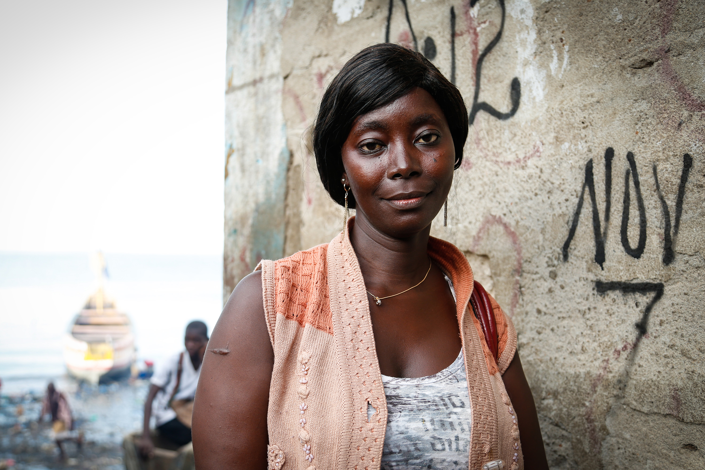
English: Isatu Bangura, 32, stands near the water's edge in Magazine Wharf - one of Freetown's largest slums, where families were hit hard by the Ebola outbreak.
Isatu survived Ebola after receiving treatment in Hastings, near Freetown. But tragically, she lost her mother, father and sister to the disease. Now she is caring for her sister's two orphaned children, alongside her own three kids. With the extra mouths to feed, she struggles to make ends meet. As well as losing her family, Isatu lost her business: she had previously been a fishmonger in Magazine Wharf, but her tools and goods were destroyed as she was placed in quarantine: a necessary but devastating measure to help control the disease. "So many people have lost their livelihoods", says Isatu. "I have hope that the government will help". But Isatu is not focussed on her own needs – she's looking forward to the future for her kids: "The only thing I ask is for my children to be educated, so that one day, they can make it for themselves". As the country nears the end of the Ebola outbreak, Isatu looks back: "We were suffering until the world turned its eyes to this problem. I'm happy that it's nearly over, but I am sad because I lost my family." The Ebola outbreak is nearing its end in Sierra Leone: the country is set to be declared Ebola free on Saturday 7 November. UK aid will support a longer term package of help for Ebola survivors, helping them to restore their livelihoods, making sure they have access to healthcare and tackling the stigma they may face when reintegrating into their communities. Picture: Simon Davis/DFID Free-to-use photo This image is posted under a Creative Commons - Attribution Licence, in accordance with the Open Government Licence. You are free to embed, download or otherwise re-use it, as long as you credit the source as 'Simon Davis/DFID'. |
| Date | |
| Source | https://www.flickr.com/photos/dfid/22747541342/ |
| Author | DFID - UK Department for International Development |
| Camera location | | View this and other nearby images on: OpenStreetMap |
|---|
Licensing edit
- You are free:
- to share – to copy, distribute and transmit the work
- to remix – to adapt the work
- Under the following conditions:
- attribution – You must give appropriate credit, provide a link to the license, and indicate if changes were made. You may do so in any reasonable manner, but not in any way that suggests the licensor endorses you or your use.
| This image was originally posted to Flickr by DFID - UK Department for International Development at https://flickr.com/photos/14214150@N02/22747541342 (archive). It was reviewed on 30 December 2019 by FlickreviewR 2 and was confirmed to be licensed under the terms of the cc-by-2.0. |
File history
Click on a date/time to view the file as it appeared at that time.
| Date/Time | Thumbnail | Dimensions | User | Comment | |
|---|---|---|---|---|---|
| current | 19:01, 30 December 2019 | | 3,000 × 2,000 (1.58 MB) | Rosiestep (talk | contribs) | User created page with UploadWizard |
You cannot overwrite this file.
File usage on Commons
The following page uses this file: