File:Isles of Scilly aerial view 2007.jpg

Size of this preview: 632 × 599 pixels. Other resolutions: 253 × 240 pixels | 506 × 480 pixels | 810 × 768 pixels | 1,080 × 1,024 pixels | 2,159 × 2,048 pixels | 7,776 × 7,376 pixels.
Original file (7,776 × 7,376 pixels, file size: 13.07 MB, MIME type: image/jpeg)
Captions
Captions
Add a one-line explanation of what this file represents
Summary edit
| Description |
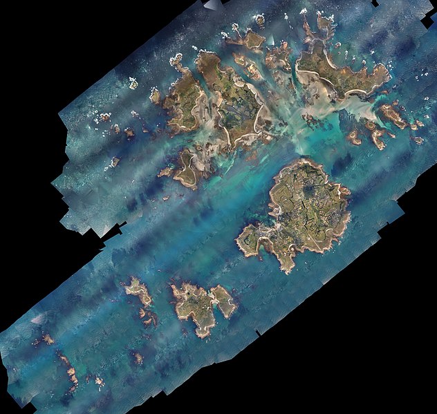
English: Vertical aerial photography showing the Isles of Scilly |
| Date | |
| Source | Defra Data Services Platform |
| Author | Environment Agency |
| Camera location | | View this and other nearby images on: OpenStreetMap |
|---|
Licensing edit
_(St_Edwards_Crown).svg)
|
This file is licensed under the United Kingdom Open Government Licence v3.0. |
See also: Meta for information on usage on Wikimedia wikis.
|
File history
Click on a date/time to view the file as it appeared at that time.
| Date/Time | Thumbnail | Dimensions | User | Comment | |
|---|---|---|---|---|---|
| current | 23:25, 28 January 2019 | | 7,776 × 7,376 (13.07 MB) | Nilfanion (talk | contribs) | User created page with UploadWizard |
You cannot overwrite this file.
File usage on Commons
The following page uses this file: