File:IsraelCVFRutm.jpg
Size of this preview: 327 × 600 pixels. Other resolutions: 131 × 240 pixels | 262 × 480 pixels | 999 × 1,832 pixels.
Original file (999 × 1,832 pixels, file size: 1.73 MB, MIME type: image/jpeg)
Captions
Captions
Add a one-line explanation of what this file represents
| Description |
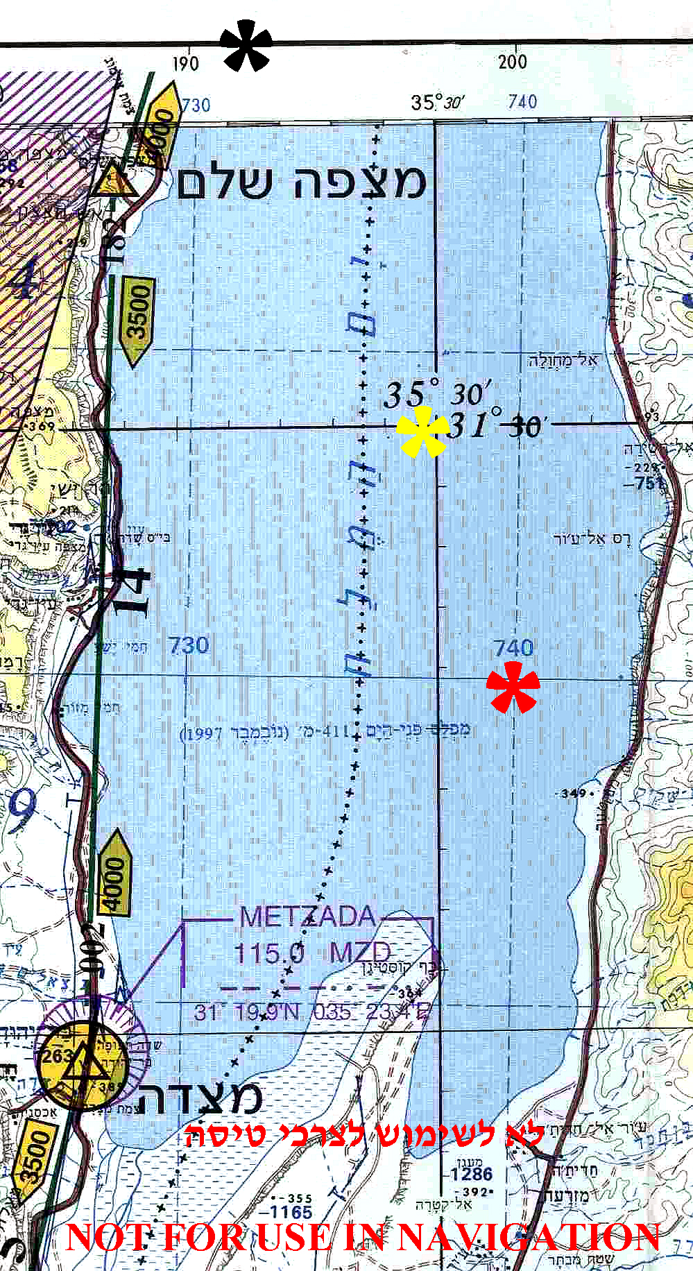
English: Universal Transverse Mercator (UTM) coordinates of Israeli topographical map.
Image to be used for illustration of aviation articles. Not for actual navigation. |
||
| Date | |||
| Source | Aeronautical Information Publication - Domestic (AIP) of the Israel Civil Aviation Administration – presently Civil Aviation Authority (CAA) | ||
| Author | Etan Tal | ||
| Permission (Reusing this file) |
|
Original image is public domain (State Regulations) - uploader added the disclaimers prohibiting navigation use in compliance with normal aviation practice. Modified image released to the public domain as well.
File history
Click on a date/time to view the file as it appeared at that time.
| Date/Time | Thumbnail | Dimensions | User | Comment | |
|---|---|---|---|---|---|
| current | 15:27, 8 October 2009 | | 999 × 1,832 (1.73 MB) | Etan J. Tal (talk | contribs) | examples of coordinates systems |
| 14:09, 8 October 2009 |  | 1,406 × 746 (312 KB) | Etan J. Tal (talk | contribs) | {{Information |Description={{en|1=Universal Transverse Mercator (UTM) coordinates of Israeli topographical map}} |Source=Aeronautical Information Publication - Domestic (AIP) of the Israel Civil Aviation Administration – presently Civil Aviation Authori |
You cannot overwrite this file.
File usage on Commons
There are no pages that use this file.
File usage on other wikis
The following other wikis use this file:
- Usage on he.wikipedia.org