File:Jacob's Island map.jpg
No higher resolution available.
Jacob's_Island_map.jpg (583 × 285 pixels, file size: 24 KB, MIME type: image/jpeg)
Captions
Captions
Add a one-line explanation of what this file represents
Summary edit
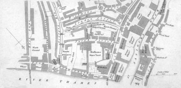
| Description | A drawing and map of Jacob's Island, a notorious slum from Victorian England, today a part of Bermondsey, London |
| Date | |
| Source | Jacob's Island, Bermondsey, 1813 |
| Author | Wise (see source) |
| Other versions |

Licensing edit
|
This work is in the public domain in its country of origin and other countries and areas where the copyright term is the author's life plus 100 years or fewer. | |
| This file has been identified as being free of known restrictions under copyright law, including all related and neighboring rights. | |
File history
Click on a date/time to view the file as it appeared at that time.
| Date/Time | Thumbnail | Dimensions | User | Comment | |
|---|---|---|---|---|---|
| current | 20:08, 3 March 2018 | | 583 × 285 (24 KB) | Belbury (talk | contribs) | File:Jacobs-island-00284-640.jpg cropped 9 % horizontally and 63 % vertically using CropTool with lossless mode. |
You cannot overwrite this file.
File usage on Commons
The following 2 pages use this file:
File usage on other wikis
The following other wikis use this file:
- Usage on en.wikipedia.org