File:James Cook NF Belle Isle.jpg
Size of this preview: 800 × 436 pixels. Other resolutions: 320 × 174 pixels | 640 × 349 pixels | 1,024 × 558 pixels | 1,766 × 962 pixels.
Original file (1,766 × 962 pixels, file size: 312 KB, MIME type: image/jpeg)
Captions
Captions
Add a one-line explanation of what this file represents
Summary edit
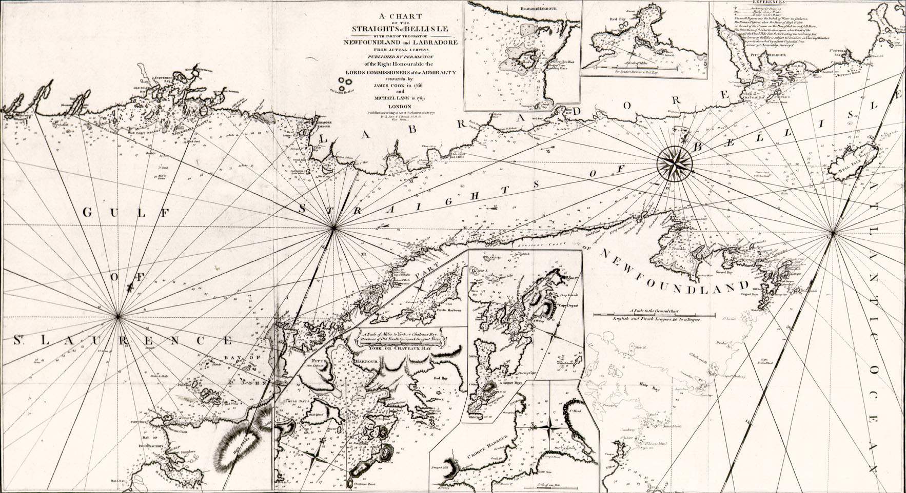
| Description | A chart of the straits of Belle Isle, including parts of the Newfoundland and Labrador coasts. Surveyed by James Cook in 1766 and Michael Lane in 1769. Printed by T. Jeffreys of London in 1770. |
| Date | |
| Source | http://www.heritage.nf.ca/exploration/chbelle_isle_500.html Courtesy of the Centre for Newfoundland Studies, Queen Elizabeth II Library, Memorial University of Newfoundland, St. John's, Newfoundland |
| Author | James Cook and Michael Lane |
| Permission (Reusing this file) |
Public domain because of age |
Licensing edit
|
This work is in the public domain in its country of origin and other countries and areas where the copyright term is the author's life plus 100 years or fewer. | |
| This file has been identified as being free of known restrictions under copyright law, including all related and neighboring rights. | |
File history
Click on a date/time to view the file as it appeared at that time.
| Date/Time | Thumbnail | Dimensions | User | Comment | |
|---|---|---|---|---|---|
| current | 11:26, 1 February 2008 | | 1,766 × 962 (312 KB) | Shipguy (talk | contribs) | == Summary == {{Information |Description=A chart of the straits of Belle Isle, including parts of the Newfoundland and Labrador coasts. Surveyed by James Cook in 1766 and Michael Lane in 1769. Printed by T. Jeffreys of London in 1770. |Source=http://www.h |
You cannot overwrite this file.
File usage on Commons
There are no pages that use this file.
File usage on other wikis
The following other wikis use this file:
- Usage on fr.wiktionary.org