File:Jan Mayen map by Carl Vogt 1863.jpg
Size of this preview: 800 × 498 pixels. Other resolutions: 320 × 199 pixels | 640 × 398 pixels | 1,024 × 637 pixels | 1,476 × 918 pixels.
Original file (1,476 × 918 pixels, file size: 280 KB, MIME type: image/jpeg)
Captions
Captions
Add a one-line explanation of what this file represents
Summary edit
| Description |
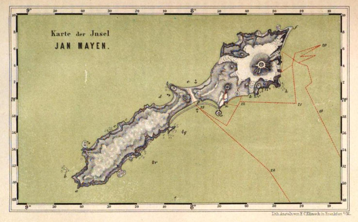
English: map of Jan Mayen island, Territory of Norway, North Atlantic Ocean plate after page 286 of Book Nord-fahrt, entlang der Norwegischen Küste, nach dem Nordkap, den Inseln Jan Mayen und Island, auf dem Schooner Joachim Hinrich unternommen während der Monate Mai bis Oktober 1861 von Dr. Georg Berna, in Begleitung von C. Vogt, H. Hasselhorst, A. Greßly und A. Herzen by Carl Vogt, Frankfurt am Main 1863. Maßstab ca. 1:630.000, Lith. Anst. von F. C. Klimsch, mehrfarbige Lithographie, mit Bergstrichen, Originalmaße 18 x 11 cm, |
| Date | |
| Source | https://books.google.de/books?id=PftdAAAAcAAJ&hl=de&hl=de&pg=PA286-IA1&img=1&zoom=3&sig=ACfU3U2GjQXQasEPCyjp7AeVsA6z4Vyu-Q&w=1025 |
| Author | Carl Vogt |
| Other versions |
https://books.google.de/books?id=99oSAAAAYAAJ&pg=PA287#v=onepage&q&f=false https://opacplus.bsb-muenchen.de/search?oclcno=230105127&db=100&View=default (Informationen zur Karte) |
Licensing edit
|
This work is in the public domain in its country of origin and other countries and areas where the copyright term is the author's life plus 100 years or fewer. | |
| This file has been identified as being free of known restrictions under copyright law, including all related and neighboring rights. | |
File history
Click on a date/time to view the file as it appeared at that time.
| Date/Time | Thumbnail | Dimensions | User | Comment | |
|---|---|---|---|---|---|
| current | 10:54, 14 January 2016 | | 1,476 × 918 (280 KB) | Mauerquadrant (talk | contribs) | Höhere Auflösung, Rand entfernt |
| 10:01, 14 January 2016 |  | 1,508 × 1,025 (267 KB) | Ratzer (talk | contribs) | {{Information |Description ={{en|1=map of Jan Mayen island, Territory of Norway, North Atlantic Ocean plate after page 286 of Book ''Nord-fahrt, entlang der Norwegischen Küste, nach dem Nordkap, den Inseln Jan Mayen und Island, auf dem Schooner Joa... |
You cannot overwrite this file.
File usage on Commons
The following 5 pages use this file:
File usage on other wikis
The following other wikis use this file:
- Usage on cs.wikipedia.org
- Usage on de.wikipedia.org
- Usage on en.wikipedia.org