File:Japan satellite view with Kii Peninsula marked.png

Size of this preview: 658 × 600 pixels. Other resolutions: 263 × 240 pixels | 527 × 480 pixels | 843 × 768 pixels | 1,124 × 1,024 pixels | 1,557 × 1,419 pixels.
Original file (1,557 × 1,419 pixels, file size: 1.26 MB, MIME type: image/png)
Captions
Captions
Add a one-line explanation of what this file represents
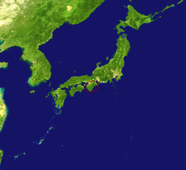
| Description | Satellite view of Japan with the Kii Peninsula marked. |
| Date | |
| Source |
|
| Author |
|
| Other versions | Derivative works of this file: Kikai location on japan map.jpg |
| This is a retouched picture, which means that it has been digitally altered from its original version. The original can be viewed here: Japan satellite.jpg:
|
| This file is in the public domain in the United States because it was solely created by NASA. NASA copyright policy states that "NASA material is not protected by copyright unless noted". (See Template:PD-USGov, NASA copyright policy page or JPL Image Use Policy.) | ||
 |
Warnings:
|
Original upload log edit
This image is a derivative work of the following images:
- File:Japan_satellite.jpg licensed with PD-USGov-NASA
- 2005-08-19T08:04:26Z っ 1557x1419 (971852 Bytes) source: http://visibleearth.nasa.gov/images/2433/land_shallow_topo_21600.tif {{PD-USGov-NASA}}
File history
Click on a date/time to view the file as it appeared at that time.
| Date/Time | Thumbnail | Dimensions | User | Comment | |
|---|---|---|---|---|---|
| current | 05:35, 16 April 2009 | | 1,557 × 1,419 (1.26 MB) | Nihonjoe (talk | contribs) | {{Information |Description=Satellite view of Japan with the Kii Peninsula marked. |Source=*Japan_satellite.jpg based on [http://visibleearth.nasa.gov/images/2433/land_shallow_topo_21600.tif this image] |
You cannot overwrite this file.
File usage on Commons
The following 2 pages use this file:
File usage on other wikis
The following other wikis use this file:
- Usage on ar.wikipedia.org
- Usage on az.wikipedia.org
- Usage on eu.wikipedia.org
- Usage on hr.wikipedia.org
- Usage on id.wikipedia.org
- Usage on it.wikipedia.org
- Usage on ko.wikipedia.org
- Usage on nl.wikipedia.org
- Usage on ru.wikipedia.org
- Usage on tr.wikipedia.org
- Usage on www.wikidata.org