File:Jardins des Champs-Élysées - OpenStreetMap 2015.svg

Size of this PNG preview of this SVG file: 512 × 380 pixels. Other resolutions: 320 × 238 pixels | 640 × 475 pixels | 1,024 × 760 pixels | 1,280 × 950 pixels | 2,560 × 1,900 pixels.
Original file (SVG file, nominally 512 × 380 pixels, file size: 247 KB)
Captions
Captions
Add a one-line explanation of what this file represents
Summary edit
| Description |
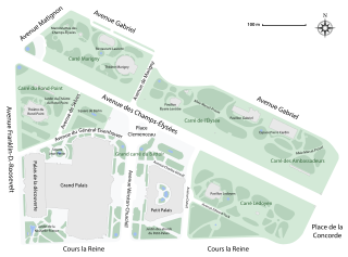
English: Map of the Jardins des Champs-Élysées, Paris, France. |
| Date | |
| Source | Own work |
| Author | Paris 16 |
Licensing edit
I, the copyright holder of this work, hereby publish it under the following license:
This file is licensed under the Creative Commons Attribution-Share Alike 4.0 International license.
- You are free:
- to share – to copy, distribute and transmit the work
- to remix – to adapt the work
- Under the following conditions:
- attribution – You must give appropriate credit, provide a link to the license, and indicate if changes were made. You may do so in any reasonable manner, but not in any way that suggests the licensor endorses you or your use.
- share alike – If you remix, transform, or build upon the material, you must distribute your contributions under the same or compatible license as the original.
File history
Click on a date/time to view the file as it appeared at that time.
| Date/Time | Thumbnail | Dimensions | User | Comment | |
|---|---|---|---|---|---|
| current | 19:31, 4 December 2020 | | 512 × 380 (247 KB) | Paris 16 (talk | contribs) | |
| 08:35, 2 February 2017 |  | 2,360 × 1,750 (354 KB) | Paris 16 (talk | contribs) | ||
| 12:59, 5 November 2015 |  | 2,360 × 1,750 (349 KB) | Paris 16 (talk | contribs) | User created page with UploadWizard |
You cannot overwrite this file.
File usage on Commons
The following 11 pages use this file:
- User:Chumwa/OgreBot/Potential transport maps/2017 February 1-9
- User:Chumwa/OgreBot/Transport Maps/2015 November 1-10
- User:Chumwa/OgreBot/Transport Maps/2017 February 1-9
- User:Chumwa/OgreBot/Transport Maps/2020 December 1-10
- User:Chumwa/OgreBot/Travel and communication maps/2017 February 1-9
- User:Chumwa/OgreBot/Travel and communication maps/2020 December 1-10
- User:Paris 16/Recent uploads/2015 November 4-6
- User:Paris 16/Recent uploads/2017 February 1-2
- User:Paris 16/Recent uploads/2020 December 3-4
- User talk:Bohème
- Commons:WikiProject Aviation/recent uploads/2017 February 2