File:Jezirat Tanb 1928 sketch map.jpg

Size of this preview: 442 × 599 pixels. Other resolutions: 177 × 240 pixels | 354 × 480 pixels | 566 × 768 pixels | 755 × 1,024 pixels | 1,834 × 2,487 pixels.
Original file (1,834 × 2,487 pixels, file size: 865 KB, MIME type: image/jpeg)
Captions
Captions
Add a one-line explanation of what this file represents
Summary edit
| Description |
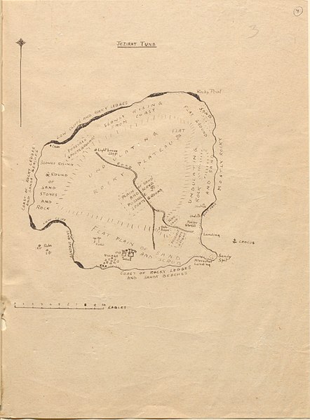
English: sketch map of Greater Tunb Island, Abu Musa Group, Persian Gulf |
| Date | |
| Source | https://www.qdl.qa/en/archive/81055/vdc_100023987987.0x00000e |
| Author | East India Company, the Board of Control, the India Office, or other British Government Department |
Licensing edit
_(St_Edwards_Crown).svg)
|
This file is licensed under the United Kingdom Open Government Licence v2.0. |
See also: Meta for information on usage on Wikimedia wikis.
|
File history
Click on a date/time to view the file as it appeared at that time.
| Date/Time | Thumbnail | Dimensions | User | Comment | |
|---|---|---|---|---|---|
| current | 09:33, 2 August 2018 | | 1,834 × 2,487 (865 KB) | Ratzer (talk | contribs) | Cropped 18 % horizontally, 35 % vertically using CropTool with lossless mode. |
| 09:32, 2 August 2018 |  | 2,231 × 3,800 (1.29 MB) | Ratzer (talk | contribs) | User created page with UploadWizard |
You cannot overwrite this file.
File usage on Commons
There are no pages that use this file.
File usage on other wikis
The following other wikis use this file:
- Usage on de.wikipedia.org