File:John E. Weyss06.jpg
Size of this preview: 708 × 599 pixels. Other resolutions: 284 × 240 pixels | 567 × 480 pixels | 900 × 762 pixels.
Original file (900 × 762 pixels, file size: 164 KB, MIME type: image/jpeg)
Captions
Captions
Add a one-line explanation of what this file represents
Summary edit
| Description |
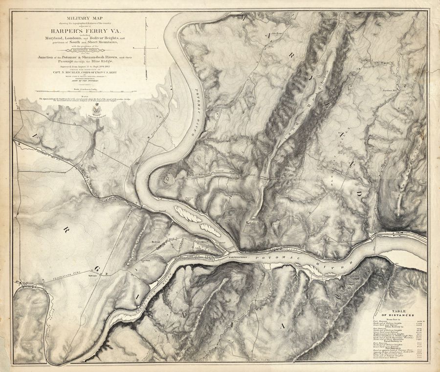
English: Military map showing the topography of the country around Harper's Ferry Va. including Maryland, Loudoun, and Bolivar Heights, and portions of South and Short Mountains, with the positions of the Defensive Works, also the Junction of the Potomac & Shenandoah Rivers, and their passage through the Blue Ridge. Surveyed from 3 August to 30 September 1863 under the direction of Capt. N. Michler, Corps of Engrs U.S. Army, By Major John E. Weyss, Principal Assistant, Engineer Department, Army Of The Potomac. |
| Date | |
| Source | http://www.historynyc.com/proddetail.asp?prod=3874000 |
| Author | John E. Weyss (1820-1903) |
Licensing edit
|
This work is in the public domain in its country of origin and other countries and areas where the copyright term is the author's life plus 100 years or fewer. | |
| This file has been identified as being free of known restrictions under copyright law, including all related and neighboring rights. | |
File history
Click on a date/time to view the file as it appeared at that time.
| Date/Time | Thumbnail | Dimensions | User | Comment | |
|---|---|---|---|---|---|
| current | 13:27, 17 June 2012 | | 900 × 762 (164 KB) | Paul venter (talk | contribs) | {{Information |Description ={{en|1= Military map showing the topography of the country around Harper's Ferry Va. including Maryland, Loudoun, and Bolivar Heights, and portions of South and Short Mountains, with the positions of the Defensive Works, ... |
You cannot overwrite this file.
File usage on Commons
There are no pages that use this file.