File:Kłodawa (gmina w województwie wielkopolskim) location map.png
Size of this preview: 560 × 600 pixels. Other resolutions: 224 × 240 pixels | 448 × 480 pixels | 677 × 725 pixels.
Original file (677 × 725 pixels, file size: 93 KB, MIME type: image/png)
Captions
Captions
Add a one-line explanation of what this file represents
| Description |
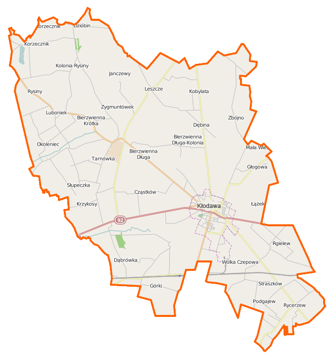
Polski: Mapa gminy Kłodawa, Polska
English: Map of Gmina Kłodawa, Poland |
|||||||||
| Date | ||||||||||
| Source | You may find a page on the OpenStreetMap wiki page for Kłodawa (gmina w województwie wielkopolskim) | |||||||||
| Creator |
OpenStreetMap contributors OpenStreetMap contributors |
|||||||||
| Permission (Reusing this file) |
OpenStreetMap data is available under the Open Database License (details). Map tiles are licensed under the Creative Commons Attribution-ShareAlike 2.0 license (CC-BY-SA 2.0).
This file is licensed under the Creative Commons Attribution-Share Alike 2.0 Generic license.
|
|||||||||
| Geotemporal data | ||||||||||
| Bounding box |
|
|||||||||
| Georeferencing | If inappropriate please set warp_status = skip to hide. | |||||||||
File history
Click on a date/time to view the file as it appeared at that time.
| Date/Time | Thumbnail | Dimensions | User | Comment | |
|---|---|---|---|---|---|
| current | 09:22, 8 December 2014 | | 677 × 725 (93 KB) | VanWiel (talk | contribs) | {{OpenStreetMap | name = Kłodawa (gmina w województwie wielkopolskim) | location = Kłodawa (gmina w województwie wielkopolskim) | description = {{pl|Mapa gminy Kłodawa, Polska}} {{en|Map of Gmina Kłodawa, Poland... |
You cannot overwrite this file.
File usage on Commons
There are no pages that use this file.
File usage on other wikis
The following other wikis use this file:
- Usage on pl.wikipedia.org
- Kłodawa (gmina w województwie wielkopolskim)
- Bierzwienna Długa
- Bierzwienna Długa-Kolonia
- Bierzwienna Krótka
- Dzióbin
- Janczewy
- Kęcerzyn
- Kobylata
- Korzecznik
- Luboniek
- Okoleniec
- Pomarzany Fabryczne
- Rgielew
- Rycerzew
- Rysiny-Kolonia
- Słupeczka
- Wólka Czepowa
- Górki (województwo wielkopolskie)
- Łążek (województwo wielkopolskie)
- Podgajew (województwo wielkopolskie)
- Zbójno (województwo wielkopolskie)
- Cząstków (powiat kolski)
- Dąbrówka (powiat kolski)
- Dębina (powiat kolski)
- Głogowa (powiat kolski)
- Rysiny (powiat kolski)
- Krzykosy (gmina Kłodawa)
- Leszcze (gmina Kłodawa)
- Straszków (wieś w gminie Kłodawa)
- Kłodawa
- Kłodawa (stacja kolejowa)
- Kopalnia Soli Kłodawa
- Łubno (Cząstków)
- Tarnówka (gmina Kłodawa)
- Kościół Wniebowzięcia Najświętszej Maryi Panny w Kłodawie
- Browar Zodiak
- Parafia Wniebowzięcia Najświętszej Maryi Panny w Kłodawie
- Parafia św. Dominika w Bierzwiennie Długiej
- Cegielnia (powiat kolski)
- Józefów Guzowski
- Mała Wieś (powiat kolski)
- Marynki (województwo wielkopolskie)
- Straszków (osada w gminie Kłodawa)
- Straszkówek
- Zygmuntówek (powiat kolski)
- Liceum Ogólnokształcące w Kłodawie
- Ratusz w Kłodawie
- Kościół św. Fabiana i Sebastiana w Kłodawie
- Rycerzew (przystanek kolejowy)
- Straszkówek (przystanek kolejowy)
View more global usage of this file.
_location_map.png)
_location_map.png&oldid=664920809)