File:KAARTEN SGD - Rijkswegenplan 1965 Noord-Holland.jpg
No higher resolution available.
KAARTEN_SGD_-_Rijkswegenplan_1965_Noord-Holland.jpg (322 × 474 pixels, file size: 53 KB, MIME type: image/jpeg)
Captions
Captions
Add a one-line explanation of what this file represents
Summary
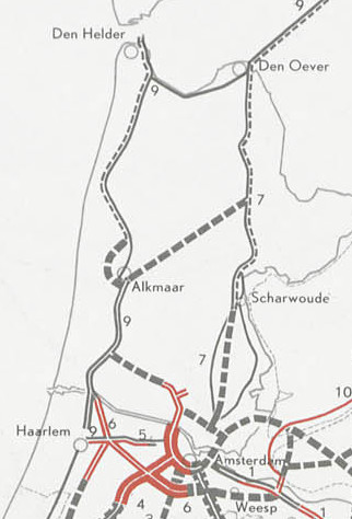
edit| Title |
KAARTEN SGD - Rijkswegenplan |
||||||||||||||||||||||||||
| Description |
Behoort bij de Instelling van een Rijkswegenfonds (Wet op het Rijkswegenfonds) |
||||||||||||||||||||||||||
| Date | |||||||||||||||||||||||||||
| Source |
This image in context: http://www.statengeneraaldigitaal.nl/document?id=sgd:mpeg21:19641965:0002137&pagina=5;
|
||||||||||||||||||||||||||
| Creator |
English: The individual creators of this map are unknown, it was commissioned by the House of Representatives of the Netherlands.
Nederlands: De precieze makers van deze kaart zijn niet bekend, hij werd in opdracht van de Tweede Kamer der Staten-Generaal gemaakt. |
||||||||||||||||||||||||||
| Permission (Reusing this file) |
|
||||||||||||||||||||||||||
| Geotemporal data | |||||||||||||||||||||||||||
| Date depicted | |||||||||||||||||||||||||||
| Map location | Nederland | ||||||||||||||||||||||||||
| Scale | ca. 1:1.100.000 | ||||||||||||||||||||||||||
| Bounding box |
|
||||||||||||||||||||||||||
| Georeferencing | If inappropriate please set warp_status = skip to hide. | ||||||||||||||||||||||||||
| Bibliographic data | |||||||||||||||||||||||||||
| Publisher |
This map was commissioned and published by the
|
||||||||||||||||||||||||||
| Archival data | |||||||||||||||||||||||||||
| Collection |
This map was digitized by the
|
||||||||||||||||||||||||||
| Notes |
Nederlands: wegenplanning |
||||||||||||||||||||||||||
| Other versions | |||||||||||||||||||||||||||


File history
Click on a date/time to view the file as it appeared at that time.
| Date/Time | Thumbnail | Dimensions | User | Comment | |
|---|---|---|---|---|---|
| current | 12:34, 20 July 2020 | | 322 × 474 (53 KB) | AlanyaSeeburg (talk | contribs) | File:KAARTEN SGD - Rijkswegenplan.jpeg cropped 81 % horizontally, 81 % vertically using CropTool with precise mode. |
You cannot overwrite this file.
File usage on Commons
The following 3 pages use this file:
File usage on other wikis
The following other wikis use this file:
- Usage on de.wikipedia.org