File:KMB261S RtMap.png
Size of this preview: 800 × 499 pixels. Other resolutions: 320 × 200 pixels | 640 × 399 pixels | 1,024 × 639 pixels | 1,628 × 1,016 pixels.
Original file (1,628 × 1,016 pixels, file size: 60 KB, MIME type: image/png)
Captions
Captions
Add a one-line explanation of what this file represents
Summary edit
| Description |
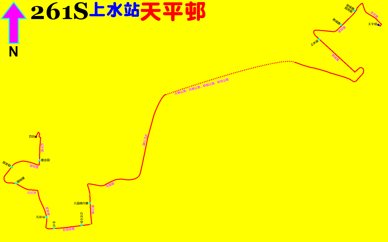
中文(繁體):九巴261S線的走線圖 |
| Date | |
| Source | Own work |
| Author | ATR50 |
Licensing edit
I, the copyright holder of this work, hereby publish it under the following license:
This file is licensed under the Creative Commons Attribution-Share Alike 4.0 International license.
- You are free:
- to share – to copy, distribute and transmit the work
- to remix – to adapt the work
- Under the following conditions:
- attribution – You must give appropriate credit, provide a link to the license, and indicate if changes were made. You may do so in any reasonable manner, but not in any way that suggests the licensor endorses you or your use.
- share alike – If you remix, transform, or build upon the material, you must distribute your contributions under the same or compatible license as the original.
File history
Click on a date/time to view the file as it appeared at that time.
| Date/Time | Thumbnail | Dimensions | User | Comment | |
|---|---|---|---|---|---|
| current | 04:36, 14 September 2022 | | 1,628 × 1,016 (60 KB) | ATR50~commonswiki (talk | contribs) | 2022年9月5日:改經石排頭路及震寰路 |
| 15:07, 3 September 2019 |  | 1,837 × 1,110 (59 KB) | ATR50~commonswiki (talk | contribs) | User created page with UploadWizard |
You cannot overwrite this file.
File usage on Commons
The following 7 pages use this file:
- User:Chumwa/OgreBot/Potential transport maps/2019 September 1-10
- User:Chumwa/OgreBot/Public transport information/2019 September 1-10
- User:Chumwa/OgreBot/Public transport information/2022 September 11-20
- User:Chumwa/OgreBot/Transport Maps/2019 September 1-10
- User:Chumwa/OgreBot/Transport Maps/2022 September 11-20
- User:Chumwa/OgreBot/Travel and communication maps/2019 September 1-10
- User:Chumwa/OgreBot/Travel and communication maps/2022 September 11-20