File:KRlandencijfers.png

Size of this preview: 706 × 600 pixels. Other resolutions: 283 × 240 pixels | 565 × 480 pixels | 904 × 768 pixels | 1,206 × 1,024 pixels | 1,280 × 1,087 pixels.
Original file (1,280 × 1,087 pixels, file size: 85 KB, MIME type: image/png)
Captions
Captions
Add a one-line explanation of what this file represents
| Description |
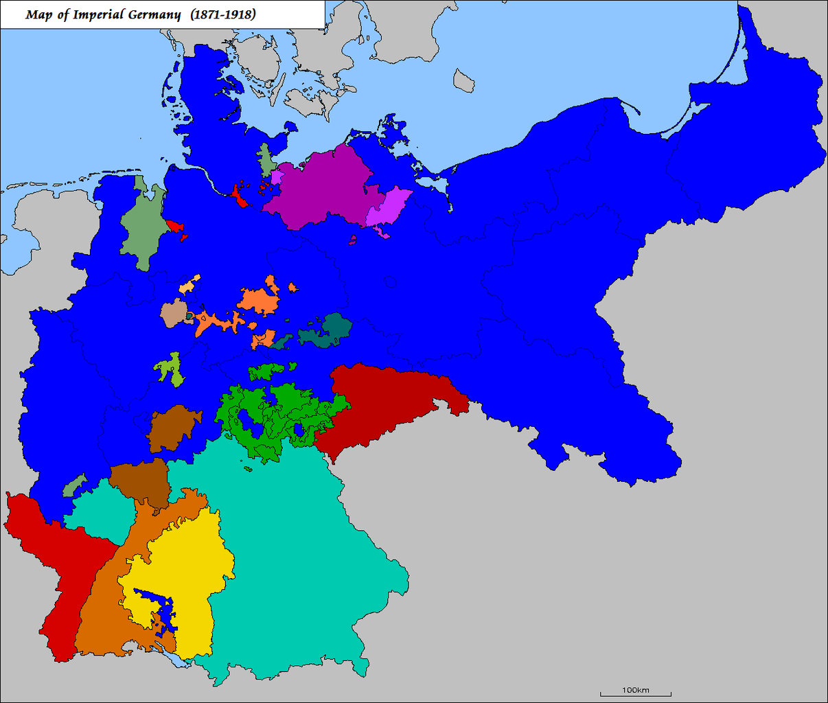
English: Map of the federal countries of the German Empire, 1871-1918, which includes the provinces of the Kingdom of Prussia
Nederlands: Kaart van de federale landen van het Duitse Keizerrijk, 1871-1918, die de provincies van het Koninkrijk Pruisen omvat
Deutsch: Karte der Bundesländer des Deutsches Kaiserreich, 1871-1918, die die Provinzen des Königreich Preußen schließt |
| Date | 19 November 2005 (original upload date) |
| Source | Transferred from nl.wikipedia to Commons by Koektrommel using CommonsHelper. |
| Author | The original uploader was Känsterle at Dutch Wikipedia. |
| Other versions | File:Map-deutsches-kaiserreich.png, File:Map-deutsches-kaiserreich-preussen.png |
Licensing edit

|
Permission is granted to copy, distribute and/or modify this document under the terms of the GNU Free Documentation License, Version 1.2 or any later version published by the Free Software Foundation; with no Invariant Sections, no Front-Cover Texts, and no Back-Cover Texts. A copy of the license is included in the section entitled GNU Free Documentation License. |
| This file is licensed under the Creative Commons Attribution-Share Alike 3.0 Unported license. | ||
| ||
| This licensing tag was added to this file as part of the GFDL licensing update. |
Original upload log edit
The original description page was here. All following user names refer to nl.wikipedia.
- 2005-11-19 14:47 Känsterle 1200×1015× (86010 bytes) Bondslanden van het Duitse Keizerrijk - gebaseerd op [[:Afbeelding:Map-deutsches-kaiserreich-preussen.png]] door [[:de:Benutzer:mrnett1974]].
File history
Click on a date/time to view the file as it appeared at that time.
| Date/Time | Thumbnail | Dimensions | User | Comment | |
|---|---|---|---|---|---|
| current | 02:51, 2 February 2011 | | 1,280 × 1,087 (85 KB) | Maps & Lucy (talk | contribs) | much clearer version |
| 18:46, 7 September 2009 |  | 1,200 × 1,015 (84 KB) | File Upload Bot (Magnus Manske) (talk | contribs) | {{BotMoveToCommons|nl.wikipedia|year={{subst:CURRENTYEAR}}|month={{subst:CURRENTMONTHNAME}}|day={{subst:CURRENTDAY}}}} {{Information |Description={{nl|Bondslanden van het Duitse Keizerrijk - gebaseerd op [[:nl::Afbeelding:Map-deutsches-kaiserreich-preuss |
You cannot overwrite this file.
File usage on Commons
There are no pages that use this file.