File:KY 588 bridge at Blackey.jpg

Size of this preview: 800 × 532 pixels. Other resolutions: 320 × 213 pixels | 640 × 426 pixels | 1,024 × 681 pixels | 1,280 × 851 pixels | 2,560 × 1,702 pixels | 6,016 × 4,000 pixels.
Original file (6,016 × 4,000 pixels, file size: 6.39 MB, MIME type: image/jpeg)
Captions
Captions
Add a one-line explanation of what this file represents
| Camera location | | View this and other nearby images on: OpenStreetMap |
|---|
| Description |
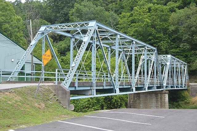
English: Southeastern portal and northeastern (upstream) side of the bridge that carries Kentucky Route 588 over the North Fork of the Kentucky River, connecting Kentucky Route 7 and downtown, at Blackey, Kentucky, United States. A builder's plate dates the bridge to 1930. |
||
| Date | Taken on 17 June 2017 | ||
| Source | Own work | ||
| Author | Nyttend | ||
| Permission (Reusing this file) |
|
File history
Click on a date/time to view the file as it appeared at that time.
| Date/Time | Thumbnail | Dimensions | User | Comment | |
|---|---|---|---|---|---|
| current | 11:40, 3 July 2017 | | 6,016 × 4,000 (6.39 MB) | Nyttend (talk | contribs) | {{Location|37|8|25.5|N|82|58|49|W}} {{Information |Description={{en|Southeastern portal and northeastern (upstream) side of the bridge that carries {{w|Kentucky Route 588}} over the North Fork of the {{w|Kentucky River}}, connecting {{w|Kentucky Route... |
You cannot overwrite this file.
File usage on Commons
There are no pages that use this file.
File usage on other wikis
The following other wikis use this file:
- Usage on sr.wikipedia.org