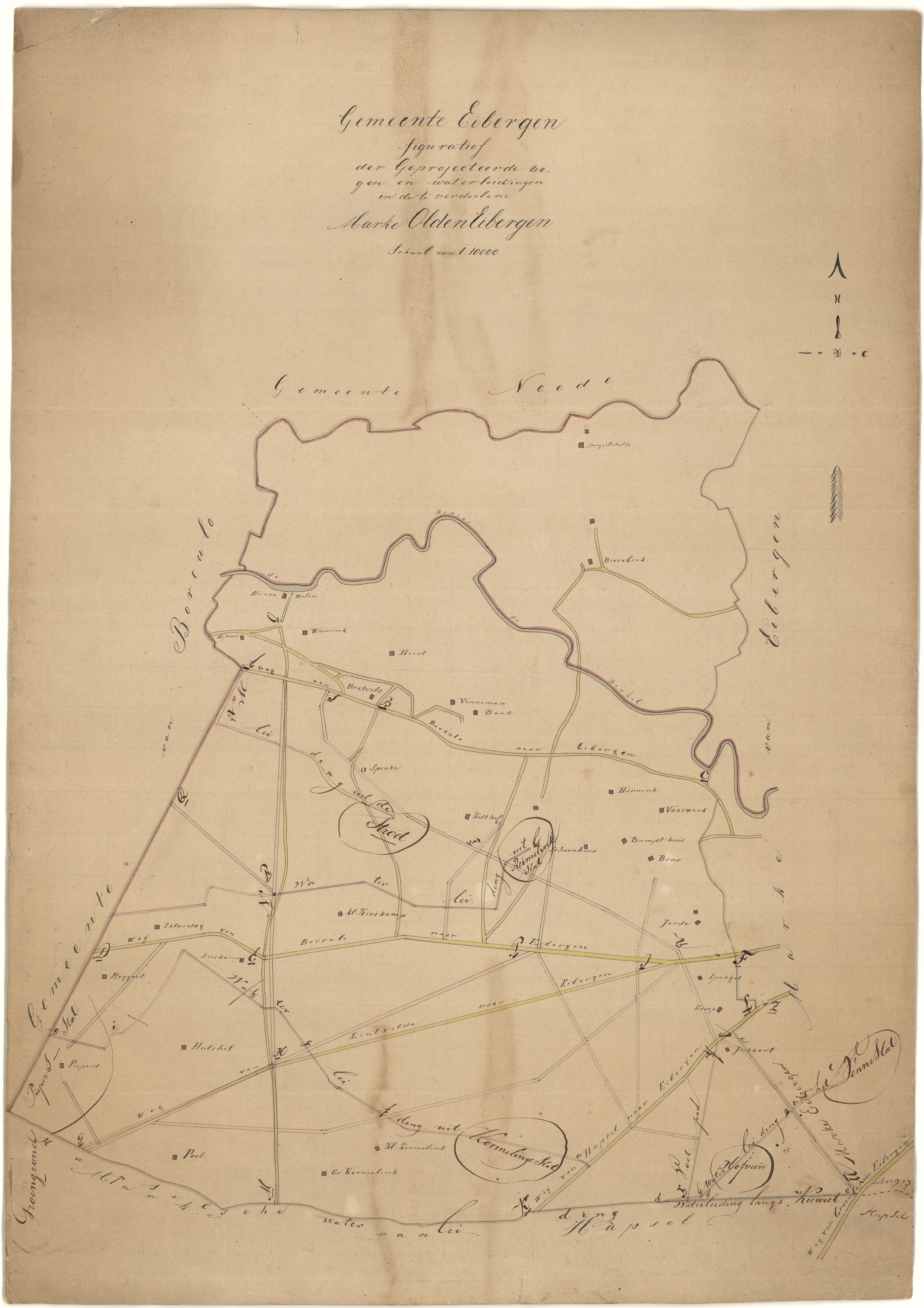
File:Kaart Geesteren met huis- en boerderijnamen ECAL 1835 1394-40.jpg
Size of this preview: 423 × 599 pixels. Other resolutions: 169 × 240 pixels | 339 × 480 pixels | 543 × 768 pixels | 723 × 1,024 pixels | 1,447 × 2,048 pixels | 5,222 × 7,390 pixels.
Original file (5,222 × 7,390 pixels, file size: 12.13 MB, MIME type: image/jpeg)
Captions
Captions
Add a one-line explanation of what this file represents
Summary
edit| Description |
Nederlands: Kaart 'aanwijzende de voorgestelde rigtingen der wegen onder Geesteren' met de volgende huis- en boerderijnamen: Laarberg, Hagman, Hengstegoor, Kunneman, Wormgoor, Voortman, Aaftink, Pastorie, Wissink, Aartman, Lieftink, Pasman, Unink, Bisser, Hoefman, Geerdink, Kiekebeek, Mensink, Molen, Dave, Dijkwever, Schelfers, Overbeek, Wesselink, Assink, Groot-Willink, Scherpenoord, besluit van Gedeputeerde Staten, 19-07-1836, nr. 26 |
||||||||||||||||||||
| Date | 1835 | ||||||||||||||||||||
| Medium |
English: map Nederlands: kaart |
||||||||||||||||||||
| Dimensions | height: 67.5 cm (26.5 in); width: 82.5 cm (32.4 in) | ||||||||||||||||||||
| Collection |
|
||||||||||||||||||||
| Accession number |
1394-40 |
||||||||||||||||||||
| Source/Photographer | View this file on ECAL website | ||||||||||||||||||||
| Permission (Reusing this file) |
|
||||||||||||||||||||

File history
Click on a date/time to view the file as it appeared at that time.
| Date/Time | Thumbnail | Dimensions | User | Comment | |
|---|---|---|---|---|---|
| current | 14:45, 1 November 2017 | | 5,222 × 7,390 (12.13 MB) | Lotteeilers (talk | contribs) | pattypan 17.05 |
You cannot overwrite this file.
File usage on Commons
The following page uses this file: