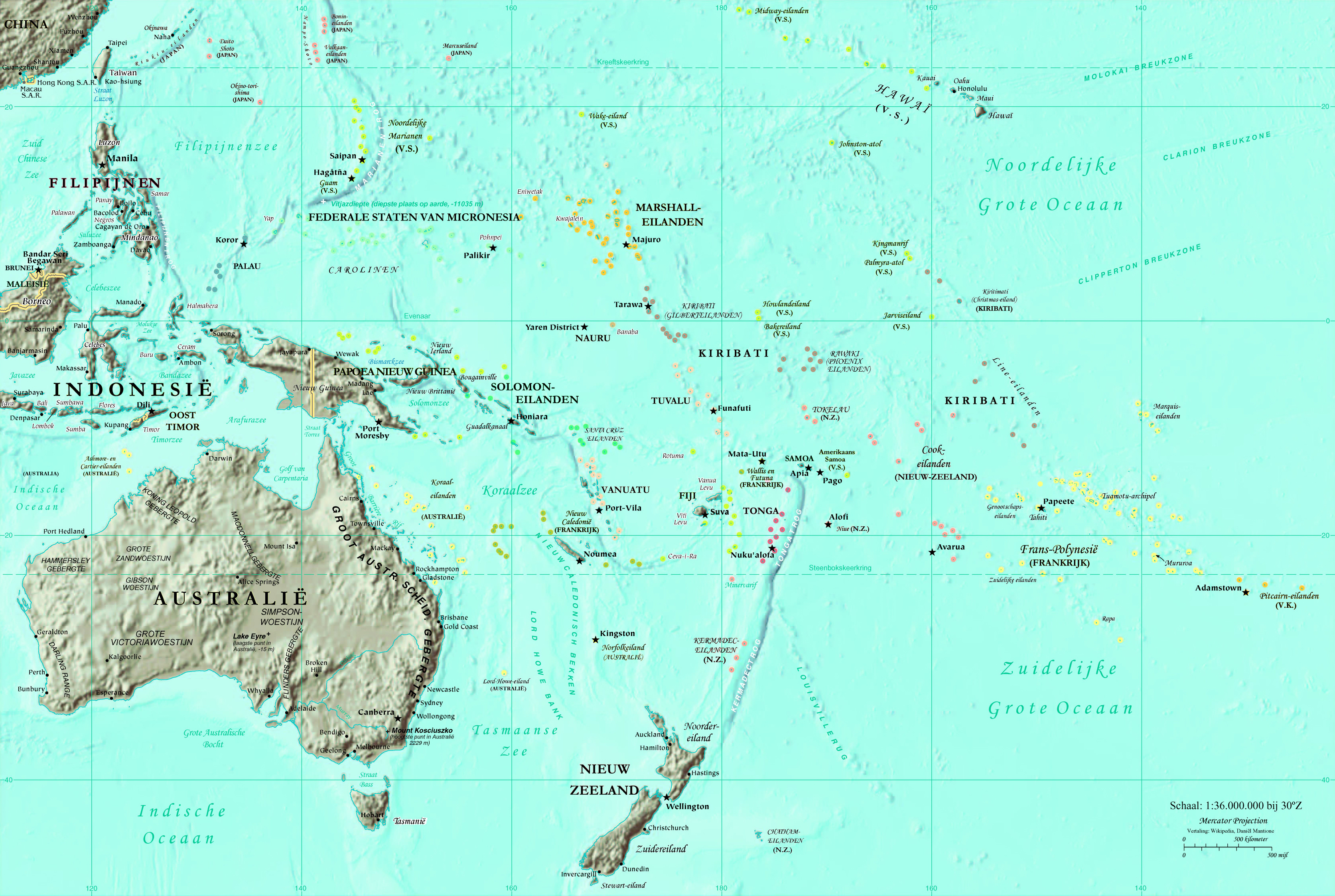
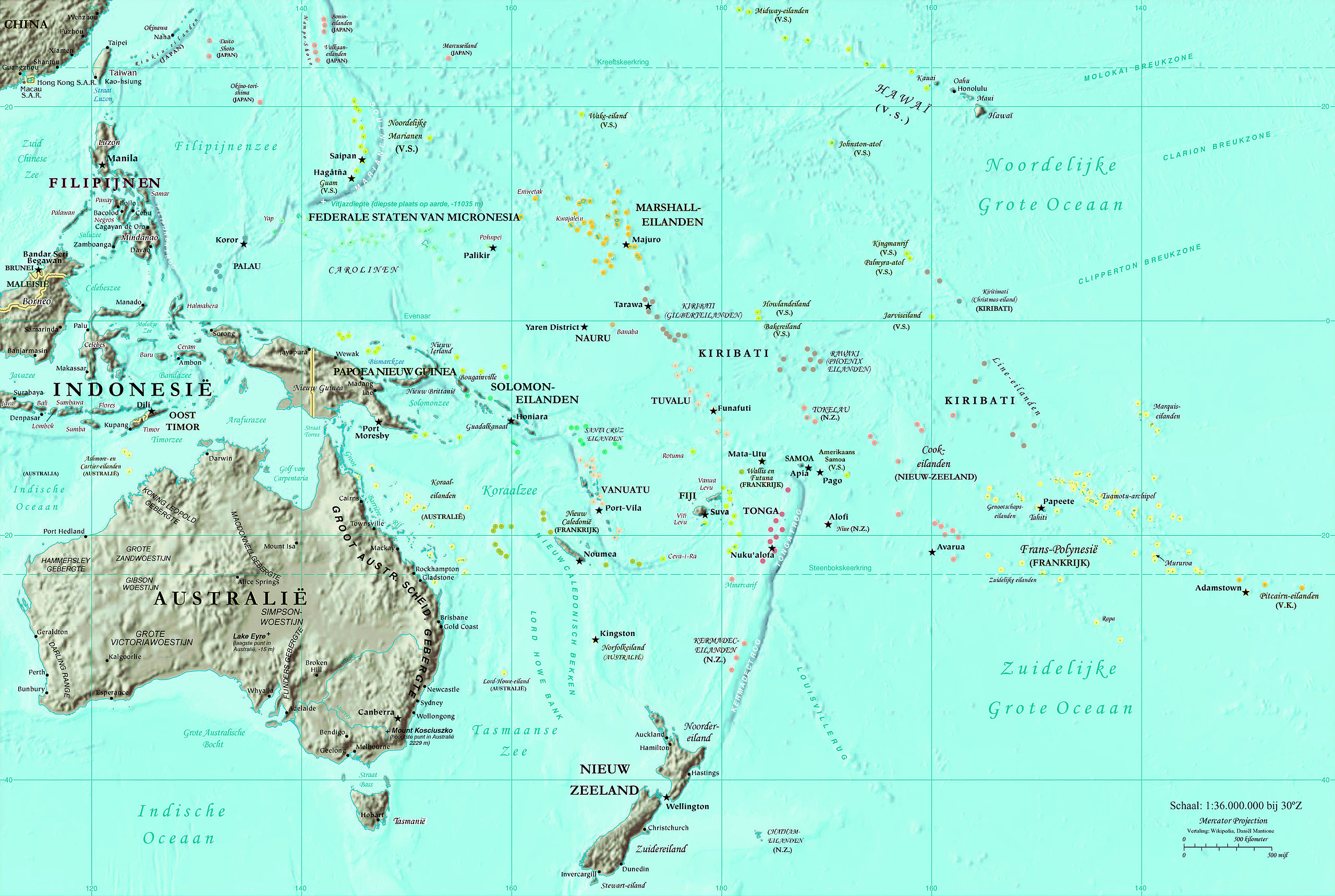
File:Kaart Oceanie.jpg
Size of this preview: 800 × 537 pixels. Other resolutions: 320 × 215 pixels | 640 × 430 pixels | 1,024 × 687 pixels | 1,280 × 859 pixels | 2,560 × 1,719 pixels | 3,347 × 2,247 pixels.
Original file (3,347 × 2,247 pixels, file size: 2.54 MB, MIME type: image/jpeg)
Captions
Captions
Add a one-line explanation of what this file represents
| Description |
Nederlands: Nederlandse vertaling CIA-kaart door nl:Gebruiker:Danielm
Gerenderd op 250 DPI. |
| Source | CIA World Fact Book |
| Author | CIA |
Licensing edit
This image is in the public domain because it contains materials that originally came from the United States Central Intelligence Agency's World Factbook.
|
 |
Original upload log edit
The original description page was here. All following user names refer to nl.wikipedia.
File history
Click on a date/time to view the file as it appeared at that time.
| Date/Time | Thumbnail | Dimensions | User | Comment | |
|---|---|---|---|---|---|
| current | 16:57, 19 June 2010 | | 3,347 × 2,247 (2.54 MB) | Ras67 (talk | contribs) | cropped |
| 16:09, 18 December 2008 |  | 3,350 × 2,298 (1.63 MB) | BotMultichill (talk | contribs) | {{BotMoveToCommons|nl.wikipedia}} {{Information |Description={{nl|Nederlandse vertaling CIA-kaart door nl:Gebruiker:Danielm Gerenderd op 250 DPI.}} |Source=Transferred from [http://nl.wikipedia.org nl.wikipedia] |Date=2004-05-25 (first version); 2 |
You cannot overwrite this file.
File usage on Commons
There are no pages that use this file.
File usage on other wikis
The following other wikis use this file:
- Usage on nl.wikipedia.org
- Usage on vls.wikipedia.org