File:Kadasterkaart Meerssen 1813-1830, sectie C, blad 1.jpg

Size of this preview: 800 × 540 pixels. Other resolutions: 320 × 216 pixels | 640 × 432 pixels | 1,024 × 691 pixels | 1,280 × 864 pixels | 2,560 × 1,727 pixels | 12,078 × 8,150 pixels.
Original file (12,078 × 8,150 pixels, file size: 10.22 MB, MIME type: image/jpeg)
Captions
Captions
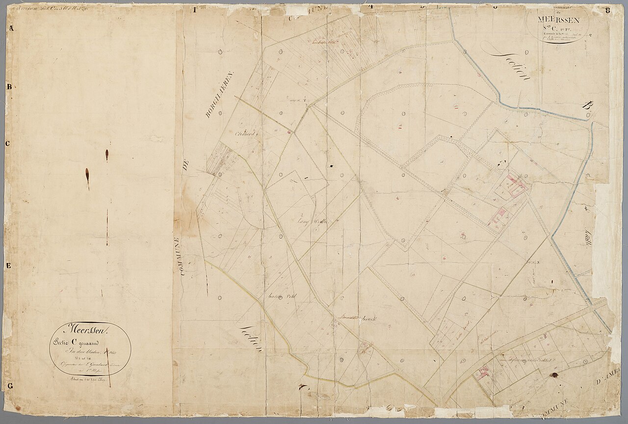
Section of a cadastral map of Meerssen, the Netherlands, circa 1813-1830.
Summary edit
| Description |
Nederlands: Kadastrale minuutkaart van Meerssen, sectie C, blad 1, perceelnummers 1-211. Op deze kaart is het gebied rondom Vaeshartelt, grenzend aan de gemeenten Amby en Borgharen weergegeven. Collectie HCL Maastricht, Kadaster Limburg, MIN11061C01. |
| Date | between 1813 and 1830 |
| Source | https://beeldbank.rhcl.nl/zoeken/groep=Beeldbank/Vrij_zoeken=kadaster%20meerssen/aantalpp=12/?nav_id=16-0 |
| Author | L.I. Groulard |
Licensing edit
| This file is made available by its copyright holder under the Creative Commons Public Domain Mark 1.0. | |
| While the Public Domain Mark is not intended to be used as a license, community consensus has found that when a copyright holder applies the PDM to their own work, they are declaring their work to be in the public domain.
If a file is tagged PDM by someone other than the copyright holder, a more specific copyright tag such as one found at Commons:Copyright tags/General public domain must be applied. If this is your own work, please use {{Cc-zero}} instead. |
File history
Click on a date/time to view the file as it appeared at that time.
| Date/Time | Thumbnail | Dimensions | User | Comment | |
|---|---|---|---|---|---|
| current | 13:58, 16 October 2023 | | 12,078 × 8,150 (10.22 MB) | Kleon3 (talk | contribs) | Uploaded a work by L.I. Groulard from https://beeldbank.rhcl.nl/zoeken/groep=Beeldbank/Vrij_zoeken=kadaster%20meerssen/aantalpp=12/?nav_id=16-0 with UploadWizard |
You cannot overwrite this file.
File usage on Commons
There are no pages that use this file.