File:Kakamas.jpg

Size of this preview: 744 × 599 pixels. Other resolutions: 298 × 240 pixels | 596 × 480 pixels | 953 × 768 pixels | 1,271 × 1,024 pixels | 2,542 × 2,048 pixels | 7,819 × 6,299 pixels.
Original file (7,819 × 6,299 pixels, file size: 30.85 MB, MIME type: image/jpeg)
Captions
Captions
Add a one-line explanation of what this file represents
Summary edit
| Description |
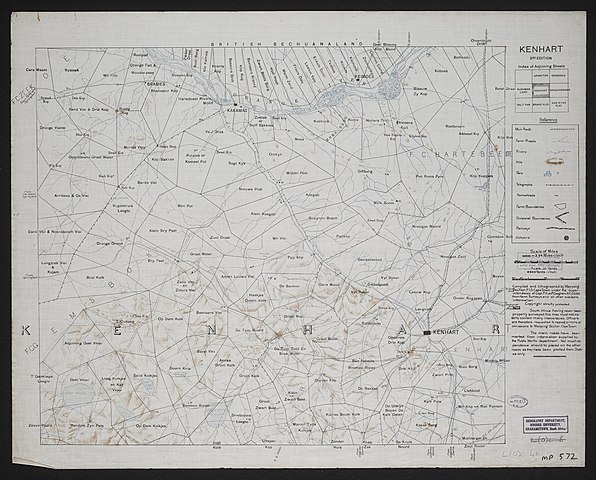
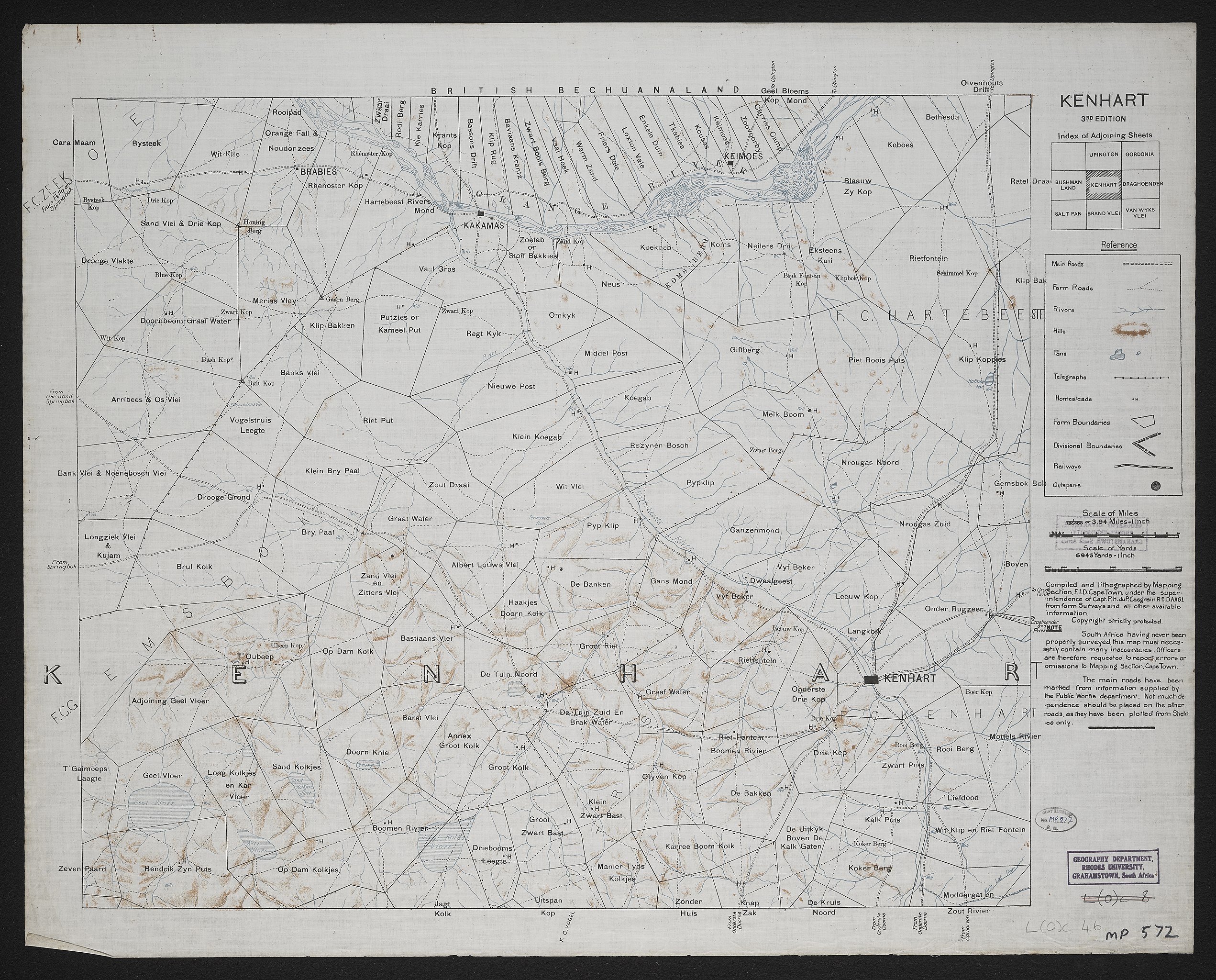
English: Kenhardt. 3rd edition. Compiled and lithographed by Mapping Section F.I.D. Cape Town, under the superintendence of Capt. P. H. du P. Casgrain. |
| Date | |
| Source | http://hdl.handle.net/10962/57441 |
| Author | Great Britain. Army. Field Intelligence Department |
| Attribution (required by the license) | Rhodes University Library / |
| Camera location | | View this and other nearby images on: OpenStreetMap |
|---|
Licensing edit
This file is licensed under the Creative Commons Attribution 4.0 International license.
- You are free:
- to share – to copy, distribute and transmit the work
- to remix – to adapt the work
- Under the following conditions:
- attribution – You must give appropriate credit, provide a link to the license, and indicate if changes were made. You may do so in any reasonable manner, but not in any way that suggests the licensor endorses you or your use.
This file, which was originally posted to
http://hdl.handle.net/10962/57441, was reviewed on 18 November 2018 by reviewer Leoboudv, who confirmed that it was available there under the stated license on that date.
|
File history
Click on a date/time to view the file as it appeared at that time.
| Date/Time | Thumbnail | Dimensions | User | Comment | |
|---|---|---|---|---|---|
| current | 03:02, 20 July 2018 | | 7,819 × 6,299 (30.85 MB) | Wynlib40 (talk | contribs) | User created page with UploadWizard |
You cannot overwrite this file.
File usage on Commons
There are no pages that use this file.
File usage on other wikis
The following other wikis use this file: