File:Karte A Ktn SP.svg

Size of this PNG preview of this SVG file: 800 × 384 pixels. Other resolutions: 320 × 154 pixels | 640 × 307 pixels | 1,024 × 492 pixels | 1,280 × 614 pixels | 2,560 × 1,229 pixels | 1,000 × 480 pixels.
Original file (SVG file, nominally 1,000 × 480 pixels, file size: 20 KB)
Captions
Captions
Add a one-line explanation of what this file represents
Summary edit
| Description |
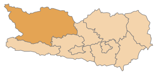
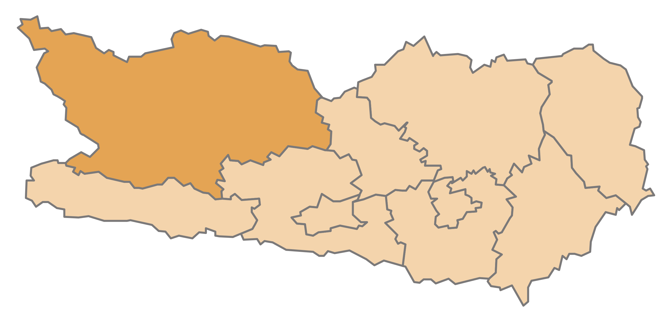
English: Map of the Austrian State Carinthia, highlighting Spittal an der Drau
Deutsch: Karte des österreichischen Bundeslandes Kärnten, Spittal an der Drau hervorgehoben |
| Date | |
| Source | Own work |
| Author | AleXXw |
Licensing edit
| I, the copyright holder of this work, release this work into the public domain. This applies worldwide. In some countries this may not be legally possible; if so: I grant anyone the right to use this work for any purpose, without any conditions, unless such conditions are required by law. |
File history
Click on a date/time to view the file as it appeared at that time.
| Date/Time | Thumbnail | Dimensions | User | Comment | |
|---|---|---|---|---|---|
| current | 20:43, 13 May 2009 | | 1,000 × 480 (20 KB) | AleXXw (talk | contribs) | == Beschreibung == {{Information |Description={{en|1=Map of the Austrian State Carinthia, highlighting Spittal an der Drau}} {{de|1=Karte des österreichischen Bundeslandes Kärnten, Spittal an der Drau hervorgehoben}} |Source=Eigenes Werk (own work) |Aut |
You cannot overwrite this file.
File usage on Commons
The following 4 pages use this file:
File usage on other wikis
The following other wikis use this file:
- Usage on cs.wikipedia.org
- Usage on da.wikipedia.org
- Usage on de.wikipedia.org
- Usage on eo.wikipedia.org
- Distrikto Spittal an der Drau
- Spittal an der Drau
- Ŝablono:Distrikto Spittal
- Weißensee (komunumo)
- Bad Kleinkirchheim
- Mühldorf (Karintio)
- Irschen
- Winklern
- Sachsenburg (Karintio)
- Mörtschach
- Großkirchheim
- Millstatt am See
- Greifenburg
- Malta (Karintio)
- Mallnitz
- Trebesing
- Rennweg am Katschberg
- Lurnfeld
- Gmünd (Karintio)
- Flattach
- Lendorf (Drautal)
- Reißeck
- Steinfeld (Karintio)
- Stall
- Rangersdorf
- Radenthein
- Krems (Karintio)
- Dellach im Drautal
- Berg im Drautal
- Kleblach-Lind
- Obervellach
- Seeboden am Millstätter See
- Oberdrauburg
- Heiligenblut am Großglockner
- Baldramsdorf
- Usage on et.wikipedia.org
- Usage on it.wikipedia.org
- Usage on ja.wikipedia.org
- Usage on lld.wikipedia.org
- Usage on lmo.wikipedia.org
- Usage on lv.wikipedia.org
- Usage on nn.wikipedia.org
- Usage on pt.wikipedia.org
- Usage on sk.wikipedia.org
View more global usage of this file.