File:Karte Insel Norderney Nationalparkzonierung.png
Size of this preview: 799 × 266 pixels. Other resolutions: 320 × 107 pixels | 1,180 × 393 pixels.
Original file (1,180 × 393 pixels, file size: 386 KB, MIME type: image/png)
Captions
Captions
Add a one-line explanation of what this file represents
Summary edit
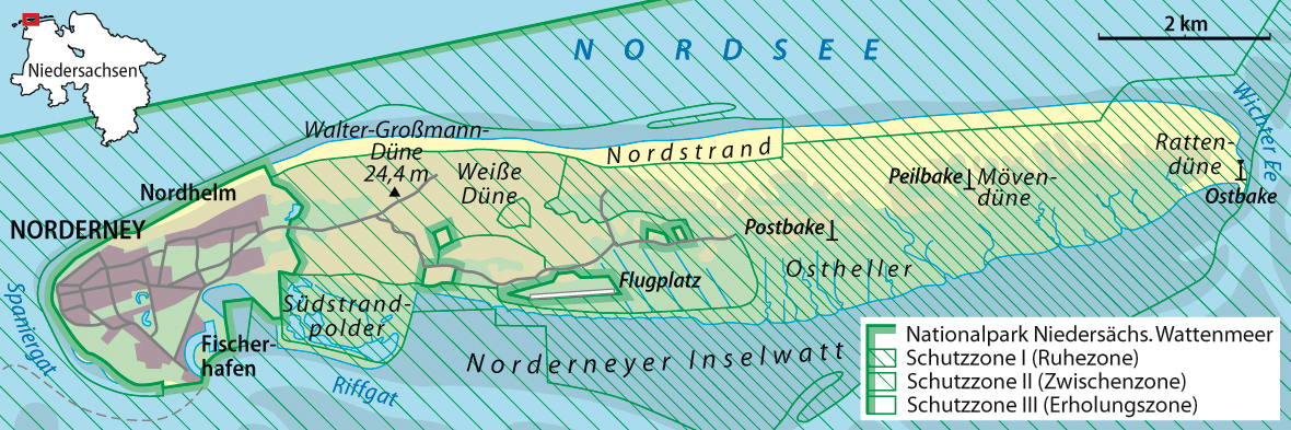
| Description |
Deutsch: Karte von Norderney mit Zonierung des Nationalparks Niedersächsisches Wattenmeer
English: Map of Norderney with zones of Lower Saxony Wadden Sea National Park |
||||||||
| Date | |||||||||
| Source |
own work, using |
||||||||
| Author | NordNordWest | ||||||||
| Permission (Reusing this file) |
I, the copyright holder of this work, hereby publish it under the following licenses:
You may select the license of your choice. |
||||||||
| Other versions |
|


|
This map has been made or improved in the German Kartenwerkstatt (Map Lab). You can propose maps to improve as well.
|
File history
Click on a date/time to view the file as it appeared at that time.
| Date/Time | Thumbnail | Dimensions | User | Comment | |
|---|---|---|---|---|---|
| current | 16:41, 27 August 2013 | 1,180 × 393 (386 KB) | NordNordWest (talk | contribs) | upd | |
| 09:30, 21 April 2009 | 1,180 × 393 (287 KB) | NordNordWest (talk | contribs) | ergänzt | ||
| 20:43, 14 April 2009 | 1,180 × 393 (287 KB) | NordNordWest (talk | contribs) | {{Information |Description= {{de|Karte von Norderney mit Zonierung des Nationalparks Niedersächsisches Wattenmeer}} {{en|Map of Norderney with zones of Lower Saxony Wadden Sea National Park}} |Source=own work |Date=14 |
You cannot overwrite this file.
File usage on Commons
The following 3 pages use this file:
File usage on other wikis
The following other wikis use this file:
- Usage on de.wikipedia.org
- Usage on www.wikidata.org