File:Karte Lübecker Landgraben.svg

Size of this PNG preview of this SVG file: 675 × 600 pixels. Other resolutions: 270 × 240 pixels | 540 × 480 pixels | 864 × 768 pixels | 1,152 × 1,024 pixels | 2,304 × 2,048 pixels | 1,053 × 936 pixels.
Original file (SVG file, nominally 1,053 × 936 pixels, file size: 1.89 MB)
Captions
Captions
Add a one-line explanation of what this file represents
Summary edit
| Description |
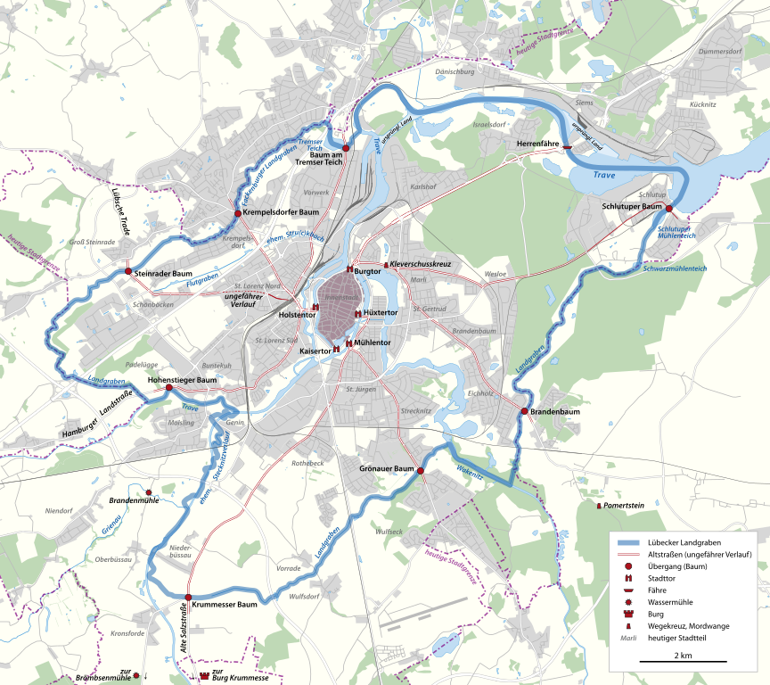
Deutsch: Karte des Lübecker Landgrabens |
||||||||||||
| Date | |||||||||||||
| Source |
Own work, using |
||||||||||||
| Author | NordNordWest | ||||||||||||
| Permission (Reusing this file) |
|
.jpg)

|
This map has been made or improved in the German Kartenwerkstatt (Map Lab). You can propose maps to improve as well.
|
File history
Click on a date/time to view the file as it appeared at that time.
| Date/Time | Thumbnail | Dimensions | User | Comment | |
|---|---|---|---|---|---|
| current | 19:15, 19 October 2011 | | 1,053 × 936 (1.89 MB) | NordNordWest (talk | contribs) | == {{int:filedesc}} == {{Information |Description= {{de|Karte des Lübecker Landgrabens}} |Source={{Own}}, using * file:LandwehrLübeck1762.jpg * file:Schlacht bei Luebeck (hochaufgeloest).jpg * [[:file:MapMoisling1 |
You cannot overwrite this file.
File usage on Commons
The following page uses this file:
File usage on other wikis
The following other wikis use this file:
- Usage on de.wikipedia.org
- Usage on www.wikidata.org