File:Karte Möllenkotten Schwelm 1788.jpg

Size of this preview: 676 × 599 pixels. Other resolutions: 271 × 240 pixels | 542 × 480 pixels | 866 × 768 pixels | 1,155 × 1,024 pixels | 2,000 × 1,773 pixels.
Original file (2,000 × 1,773 pixels, file size: 1.77 MB, MIME type: image/jpeg)
Captions
Captions
Add a one-line explanation of what this file represents
Summary edit
| Description |
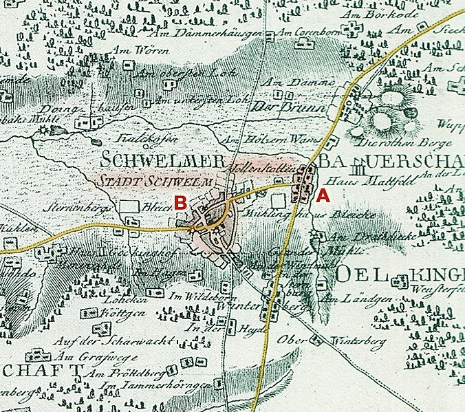
Deutsch: Ausschnitt aus der Karte "Situations Charte vom Fabrickendistrikte im Hochgericht Schwelm", 1788. Entwurf: Friedrich Christoph Müller, Kupferstich: Georg Friedrich Jonas Frentzel. Original im Museum Haus Martfeld, Schwelm. Ausschnitt wurde nachkoloriert und mit farbigen Markierungen versehen. Er zeigt einen Bereich um die Stadt Schwelm (markiert "B"), mit Dorf Möllenkotten ("A") und alten Fernstraßen (gelb). |
||||
| Date | |||||
| Source | Helbeck, Gerd: Schwelm. Geschichte einer Stadt und ihres Umlandes. 1995 | ||||
| Author | Friedrich Christoph Müller (1751-1808) | ||||
| Permission (Reusing this file) |
|
||||
File history
Click on a date/time to view the file as it appeared at that time.
| Date/Time | Thumbnail | Dimensions | User | Comment | |
|---|---|---|---|---|---|
| current | 17:41, 30 March 2019 | | 2,000 × 1,773 (1.77 MB) | Hannoverscher (talk | contribs) | {{Information |description ={{de|1=Ausschnitt aus der Karte "Situations Charte vom Fabrickendistrikte im Hochgericht Schwelm", 1788. Entwurf: Friedrich Christoph Müller, Kupferstich: Georg Friedrich Jonas Frentzel. Original im Museum Haus Martfeld, Schwelm. Ausschnitt wurde nachkoloriert und mit farbigen Markierungen versehen. Er zeigt einen Bereich um die Stadt Schwelm (markiert "B"), mit Dorf Möllenkotten ("A") und alten Fernstraßen (gelb).}} |date =1788 |source =Helbeck,... |
You cannot overwrite this file.
File usage on Commons
The following page uses this file:
File usage on other wikis
The following other wikis use this file:
- Usage on de.wikipedia.org