File:Karte Metro St Petersburg.png

Size of this preview: 480 × 599 pixels. Other resolutions: 192 × 240 pixels | 384 × 480 pixels | 615 × 768 pixels | 1,030 × 1,286 pixels.
Original file (1,030 × 1,286 pixels, file size: 338 KB, MIME type: image/png)
Captions
Captions
Add a one-line explanation of what this file represents
Summary edit
| Description |
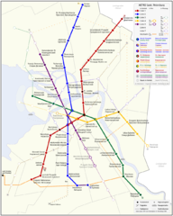
Русский: Схема метрополитена Санкт-Петербурга, Россия
English: Map of the Underground system of St. Petersburg, Russia
Deutsch: Liniennetz der Metro Sankt Petersburg, Russland |
| Date | |
| Source | own work / selbst hergestellt |
| Author | Fremantleboy 28 July 2007 (UTC) |
| Other versions |
SVG-Version: |

|
This map has been made or improved in the German Kartenwerkstatt (Map Lab). You can propose maps to improve as well.
|
Licensing edit
Fremantleboy, the copyright holder of this work, hereby publishes it under the following license:
This file is licensed under the Creative Commons Attribution 2.5 Generic license.
Attribution: Fremantleboy
- You are free:
- to share – to copy, distribute and transmit the work
- to remix – to adapt the work
- Under the following conditions:
- attribution – You must give appropriate credit, provide a link to the license, and indicate if changes were made. You may do so in any reasonable manner, but not in any way that suggests the licensor endorses you or your use.
File history
Click on a date/time to view the file as it appeared at that time.
| Date/Time | Thumbnail | Dimensions | User | Comment | |
|---|---|---|---|---|---|
| current | 22:38, 7 January 2011 | | 1,030 × 1,286 (338 KB) | Orange-kun (talk | contribs) | Januar 2011 |
| 22:34, 7 January 2011 |  | 1,030 × 1,286 (338 KB) | Orange-kun (talk | contribs) | +obvodny kanal | |
| 06:04, 12 January 2009 |  | 1,030 × 1,286 (329 KB) | Orange-kun (talk | contribs) | {{Information |Description= |Source= |Date= |Author= |Permission= |other_versions= }} | |
| 05:58, 12 January 2009 |  | 1,030 × 1,286 (329 KB) | Orange-kun (talk | contribs) | {{Information |Description= |Source= |Date= |Author= |Permission= |other_versions= }} | |
| 14:35, 19 November 2007 |  | 1,030 × 1,286 (328 KB) | Fremantleboy (talk | contribs) | Map according to the Generalplan of the city from december 2005. | |
| 09:29, 1 August 2007 |  | 1,030 × 1,286 (308 KB) | Fremantleboy (talk | contribs) | {{Information |Description= |Source= |Date= |Author= |Permission= |other_versions= }} | |
| 14:03, 31 July 2007 |  | 1,030 × 1,286 (302 KB) | Fremantleboy (talk | contribs) | ||
| 07:22, 31 July 2007 |  | 1,030 × 1,286 (307 KB) | Fremantleboy (talk | contribs) | ||
| 20:15, 30 July 2007 |  | 1,202 × 1,286 (312 KB) | Fremantleboy (talk | contribs) | ||
| 12:10, 30 July 2007 |  | 1,202 × 1,286 (261 KB) | Fremantleboy (talk | contribs) |
You cannot overwrite this file.
File usage on Commons
The following 3 pages use this file:
File usage on other wikis
The following other wikis use this file: