File:Karte Rhein-Pfalz-Kreis.png
Size of this preview: 309 × 599 pixels. Other resolutions: 124 × 240 pixels | 247 × 480 pixels | 986 × 1,912 pixels.
Original file (986 × 1,912 pixels, file size: 451 KB, MIME type: image/png)
Captions
Captions
Add a one-line explanation of what this file represents
Summary edit
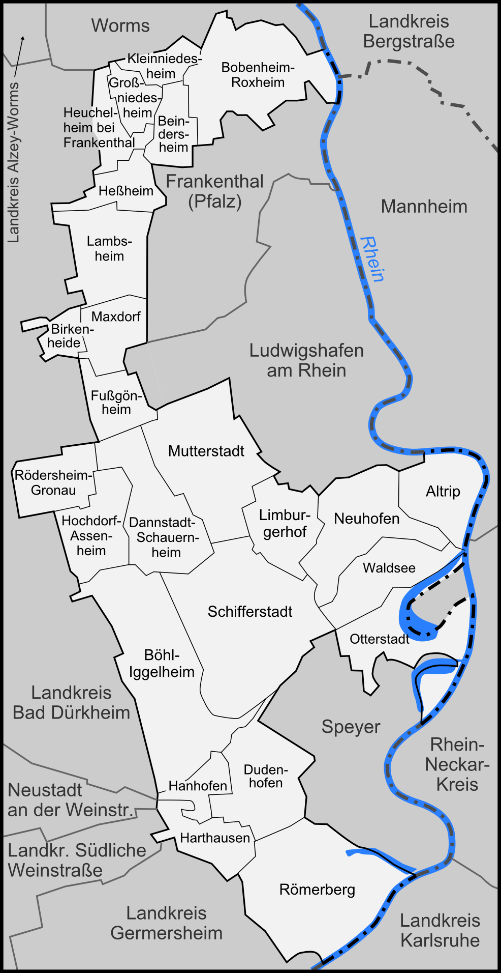
| Description | Karte der Gemeinden des Rhein-Pfalz-Kreises, sowie der umliegenden Landkreise und Kreisfreien Städte |
| Date | |
| Source | "own work", used Rhein-Pfalz-Kreis.svg by Lencer |
| Author | Lencer |
| Other versions |
 |

|
This map has been made or improved in the German Kartenwerkstatt (Map Lab). You can propose maps to improve as well.
|
Licensing edit
This file is licensed under the Creative Commons Attribution-Share Alike 3.0 Unported license.
- You are free:
- to share – to copy, distribute and transmit the work
- to remix – to adapt the work
- Under the following conditions:
- attribution – You must give appropriate credit, provide a link to the license, and indicate if changes were made. You may do so in any reasonable manner, but not in any way that suggests the licensor endorses you or your use.
- share alike – If you remix, transform, or build upon the material, you must distribute your contributions under the same or compatible license as the original.
File history
Click on a date/time to view the file as it appeared at that time.
| Date/Time | Thumbnail | Dimensions | User | Comment | |
|---|---|---|---|---|---|
| current | 18:48, 1 February 2008 | | 986 × 1,912 (451 KB) | Lencer (talk | contribs) | {{Information |Description= Karte der Gemeinden des Rhein-Pfalz-Kreises, sowie der umliegenden Landkreise und Kreisfreien Städte |Source="own work", used Rhein-Pfalz-Kreis.svg by ~~~ |Date= |
You cannot overwrite this file.
File usage on Commons
The following page uses this file:
File usage on other wikis
The following other wikis use this file:
- Usage on de.wikipedia.org
- Usage on en.wikipedia.org
- Usage on fr.wikipedia.org
- Usage on ja.wikipedia.org
- Usage on pfl.wikipedia.org
- Usage on pt.wikipedia.org
- Usage on uk.wikipedia.org