File:Karte Segelfluggelände Deutschland.svg

Size of this PNG preview of this SVG file: 443 × 599 pixels. Other resolutions: 177 × 240 pixels | 355 × 480 pixels | 568 × 768 pixels | 758 × 1,024 pixels | 1,515 × 2,048 pixels | 512 × 692 pixels.
Original file (SVG file, nominally 512 × 692 pixels, file size: 237 KB)
Captions
Captions
Add a one-line explanation of what this file represents
Summary edit
| Description |
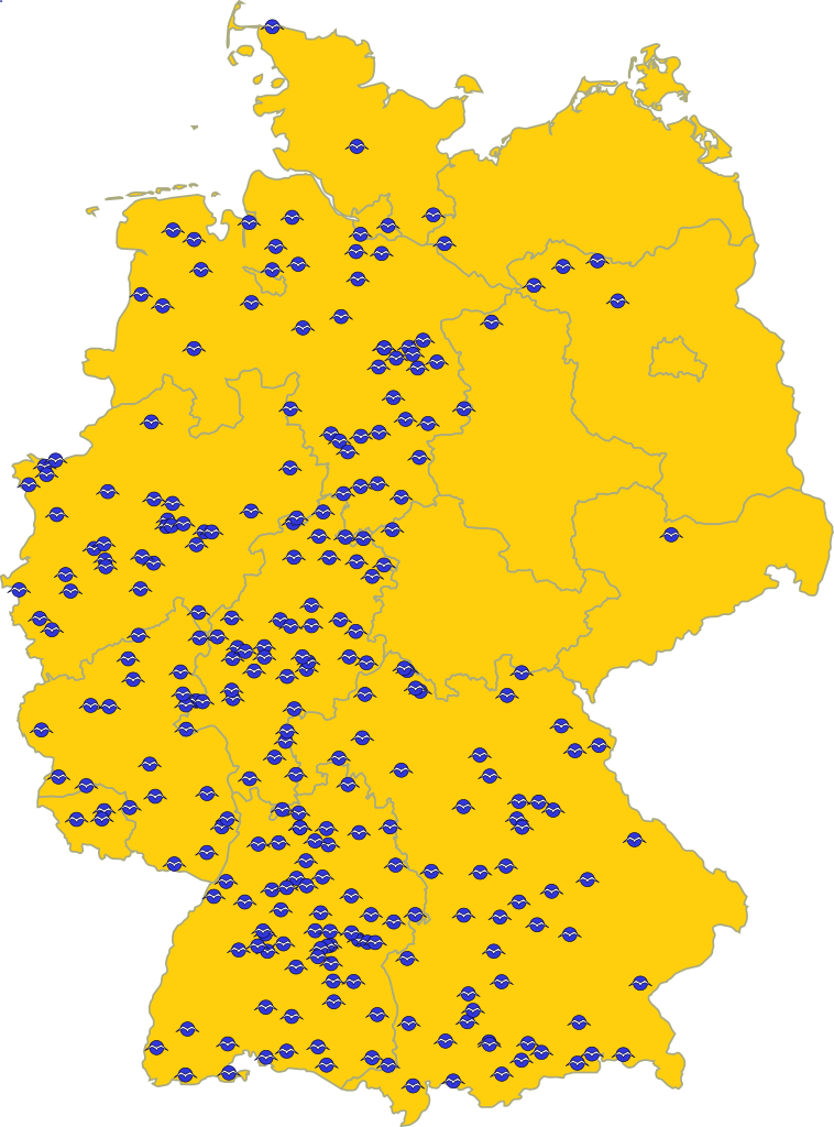
English: Map of the “Segelfluggelände” (special kind of airfield, where more or less only sailplanes are allowed) in Germany
Deutsch: Karte der de:Segelfluggelände in Deutschland |
| Date | |
| Source |
|
| Author | El Grafo |
| SVG development |
Licensing edit
I, the copyright holder of this work, hereby publish it under the following license:
| This file is made available under the Creative Commons CC0 1.0 Universal Public Domain Dedication. | |
| The person who associated a work with this deed has dedicated the work to the public domain by waiving all of their rights to the work worldwide under copyright law, including all related and neighboring rights, to the extent allowed by law. You can copy, modify, distribute and perform the work, even for commercial purposes, all without asking permission.
|
File history
Click on a date/time to view the file as it appeared at that time.
| Date/Time | Thumbnail | Dimensions | User | Comment | |
|---|---|---|---|---|---|
| current | 17:08, 9 December 2010 | | 512 × 692 (237 KB) | Fleshgrinder (talk | contribs) | Slight code optimization, title element, added support for embedding the graphic directly in HTML via the object element (width=100% height=100% viewBox"x x x x"), ... |
| 18:23, 8 December 2010 |  | 399 × 539 (244 KB) | Perhelion (talk | contribs) | use clone object | |
| 20:00, 29 November 2010 |  | 786 × 1,063 (340 KB) | El Grafo (talk | contribs) | Reverted to version as of 14:25, 29 November 2010 | |
| 20:00, 29 November 2010 |  | 524 × 744 (658 KB) | El Grafo (talk | contribs) | svg-output from qgis (for discussion) | |
| 14:25, 29 November 2010 |  | 786 × 1,063 (340 KB) | El Grafo (talk | contribs) | remove remnants of embedded raster graphics | |
| 14:21, 29 November 2010 |  | 786 × 1,063 (445 KB) | El Grafo (talk | contribs) | previous version was saved in Inkscape as "Inkscape-SVG" | |
| 14:15, 29 November 2010 |  | 786 × 1,063 (584 KB) | El Grafo (talk | contribs) | Reverted to version as of 17:41, 28 November 2010 | |
| 14:13, 29 November 2010 |  | 399 × 539 (995 KB) | El Grafo (talk | contribs) | Version with embedded raster graphics (for discussion) | |
| 17:41, 28 November 2010 |  | 786 × 1,063 (584 KB) | El Grafo (talk | contribs) | bigger | |
| 17:30, 28 November 2010 |  | 431 × 582 (445 KB) | El Grafo (talk | contribs) | {{Information |Description={{en|1=Map of the “Segelfluggelände” (special kind of airfield, where more or less only sailplanes are allowed) in Germany }} {{de|1=Karte der de:Segelfluggelände in Deutschland}} |Source=*{{own}} *mapdata from [http: |
You cannot overwrite this file.
File usage on Commons
There are no pages that use this file.
File usage on other wikis
The following other wikis use this file: