File:Karte Verbreitung Einheitsbahnhof Wuerttemberg.png
Size of this preview: 451 × 600 pixels. Other resolutions: 180 × 240 pixels | 361 × 480 pixels | 577 × 768 pixels | 770 × 1,024 pixels | 2,537 × 3,374 pixels.
Original file (2,537 × 3,374 pixels, file size: 1 MB, MIME type: image/png)
Captions
Captions
Add a one-line explanation of what this file represents
Summary edit
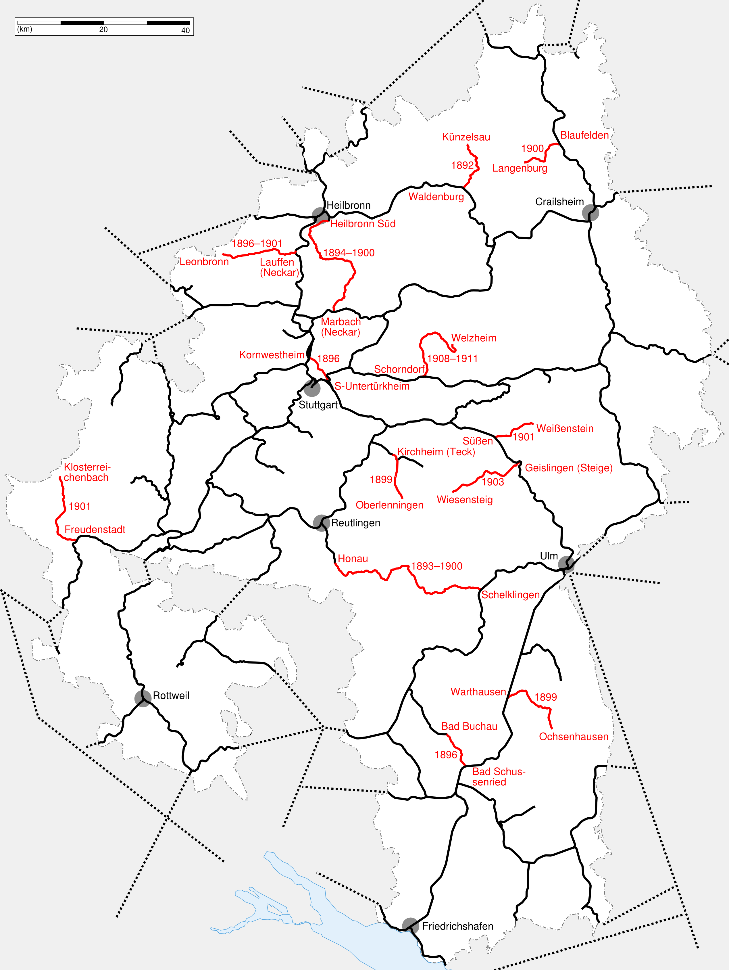
| Description |
|
| Date | |
| Source | Own work |
| Author | K. Jähne |
Licensing edit
| This work is ineligible for copyright and therefore in the public domain because it consists entirely of information that is common property and contains no original authorship. |
File history
Click on a date/time to view the file as it appeared at that time.
| Date/Time | Thumbnail | Dimensions | User | Comment | |
|---|---|---|---|---|---|
| current | 17:59, 7 December 2008 | | 2,537 × 3,374 (1 MB) | Kjunix (talk | contribs) | fix display problem |
| 17:54, 7 December 2008 |  | 3,191 × 3,923 (1.16 MB) | Kjunix (talk | contribs) | fix display problem | |
| 17:50, 7 December 2008 |  | 3,382 × 4,498 (1.39 MB) | Kjunix (talk | contribs) | == Description == {{Information| |Description = *{{de|Karte des Streckennetzes der Königlich Württembergischen Staatseisenbahnen, Stand 1920. Rot markiert: Eröffnungsabschnitte mit Einheitsbahnhöfen.}} |Source = |
You cannot overwrite this file.
File usage on Commons
There are no pages that use this file.
File usage on other wikis
The following other wikis use this file:
- Usage on de.wikipedia.org
- Usage on en.wikipedia.org