File:Karte Wanfrieder Abkommen.png

Size of this preview: 800 × 544 pixels. Other resolutions: 320 × 218 pixels | 640 × 435 pixels | 1,024 × 696 pixels | 1,280 × 870 pixels | 1,858 × 1,263 pixels.
Original file (1,858 × 1,263 pixels, file size: 332 KB, MIME type: image/png)
Captions
Captions
Add a one-line explanation of what this file represents
Summary edit
| Description |
|
| Date | |
| Source | Own work |
| Author | kjunix, using Open Street Map data |
| Permission (Reusing this file) |
This map was created from OpenStreetMap project data, collected by the community. This file is licensed under the Creative Commons Attribution-Share Alike 2.0 Generic license.
|
File history
Click on a date/time to view the file as it appeared at that time.
| Date/Time | Thumbnail | Dimensions | User | Comment | |
|---|---|---|---|---|---|
| current | 22:58, 3 October 2015 | | 1,858 × 1,263 (332 KB) | Faxel (talk | contribs) | Eingefärbt |
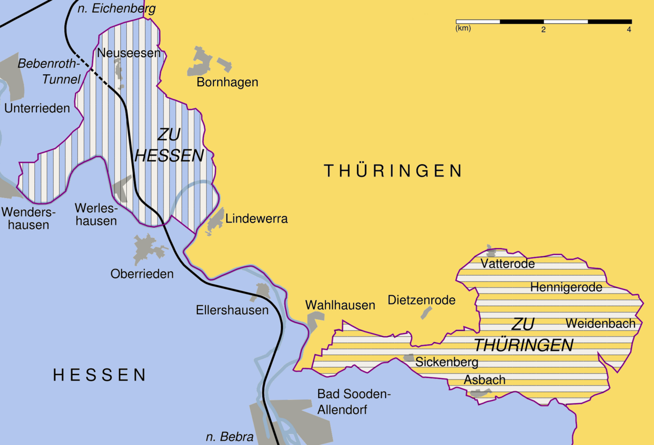
| 06:25, 5 May 2012 |  | 1,858 × 1,263 (336 KB) | Kjunix (talk | contribs) | == {{int:filedesc}} == {{Information| |Description = *{{de|Gebietstausch durch das Wanfrieder Abkommen am 17. September 1945.}} |Source = {{Own}} |Date = 2012-05-05 |Author = kjunix, using Open Street Map data |Permission = {{Op... |
You cannot overwrite this file.
File usage on Commons
The following 3 pages use this file:
File usage on other wikis
The following other wikis use this file:
- Usage on de.wikipedia.org
- Usage on en.wikipedia.org
- Usage on ko.wikipedia.org
- Usage on ru.wikipedia.org
- Usage on www.wikidata.org