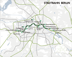
File:Karte berlin stadtbahn.png

Size of this preview: 746 × 599 pixels. Other resolutions: 299 × 240 pixels | 598 × 480 pixels | 956 × 768 pixels | 1,200 × 964 pixels.
Original file (1,200 × 964 pixels, file size: 356 KB, MIME type: image/png)
Captions
Captions
Add a one-line explanation of what this file represents

|
This transport map image could be re-created using vector graphics as an SVG file. This has several advantages; see Commons:Media for cleanup for more information. If an SVG form of this image is available, please upload it and afterwards replace this template with
{{vector version available|new image name}}.
It is recommended to name the SVG file “Karte berlin stadtbahn.svg”—then the template Vector version available (or Vva) does not need the new image name parameter. |
Summary edit
eigene Darstellung
| Source | Own work | |||||||||
| Creator | ||||||||||
| Geotemporal data | ||||||||||
| Bounding box |
|
|||||||||
| Georeferencing | ||||||||||
Licensing edit
This file is licensed under the Creative Commons Attribution-Share Alike 2.5 Generic license.
- You are free:
- to share – to copy, distribute and transmit the work
- to remix – to adapt the work
- Under the following conditions:
- attribution – You must give appropriate credit, provide a link to the license, and indicate if changes were made. You may do so in any reasonable manner, but not in any way that suggests the licensor endorses you or your use.
- share alike – If you remix, transform, or build upon the material, you must distribute your contributions under the same or compatible license as the original.
File history
Click on a date/time to view the file as it appeared at that time.
| Date/Time | Thumbnail | Dimensions | User | Comment | |
|---|---|---|---|---|---|
| current | 06:49, 18 June 2011 | | 1,200 × 964 (356 KB) | Citypeek (talk | contribs) | removal watermark |
| 03:45, 2 April 2010 |  | 1,200 × 964 (358 KB) | Pequod76 (talk | contribs) | Reverted to version as of 03:40, 2 April 2010 | |
| 03:42, 2 April 2010 |  | 1,200 × 964 (358 KB) | Pequod76 (talk | contribs) | Reverted to version as of 03:37, 2 April 2010 | |
| 03:40, 2 April 2010 |  | 1,200 × 964 (358 KB) | Pequod76 (talk | contribs) | As before. It didn't work?! | |
| 03:37, 2 April 2010 |  | 1,200 × 964 (358 KB) | Pequod76 (talk | contribs) | en: I made the line between Charlottenburg and Ostbahnhof darker. it: Ho scurito la linea ferroviaria da Charlottenburg a Ostbahnhof. | |
| 00:08, 23 January 2008 |  | 1,200 × 964 (309 KB) | Sansculotte (talk | contribs) | update | |
| 20:33, 4 September 2005 |  | 1,200 × 964 (305 KB) | Sansculotte (talk | contribs) | eigene Darstellung | |
| 20:29, 4 September 2005 |  | 1,200 × 964 (303 KB) | Sansculotte (talk | contribs) | eigene Darstellung |
You cannot overwrite this file.
File usage on Commons
The following page uses this file:
File usage on other wikis
The following other wikis use this file:
- Usage on de.wikipedia.org
- Usage on es.wikipedia.org
- Usage on fr.wikipedia.org
- Usage on it.wikipedia.org
- Usage on nl.wikipedia.org
- Usage on no.wikipedia.org
- Usage on pl.wikipedia.org
- Usage on pt.wikipedia.org
- Usage on sv.wikipedia.org
- Usage on www.wikidata.org