File:Karte der Bahnstrecke Královec–Žacléř.jpg
Size of this preview: 800 × 395 pixels. Other resolutions: 320 × 158 pixels | 640 × 316 pixels | 1,024 × 505 pixels | 1,881 × 928 pixels.
Original file (1,881 × 928 pixels, file size: 525 KB, MIME type: image/jpeg)
Captions
Captions
Add a one-line explanation of what this file represents
| Description |
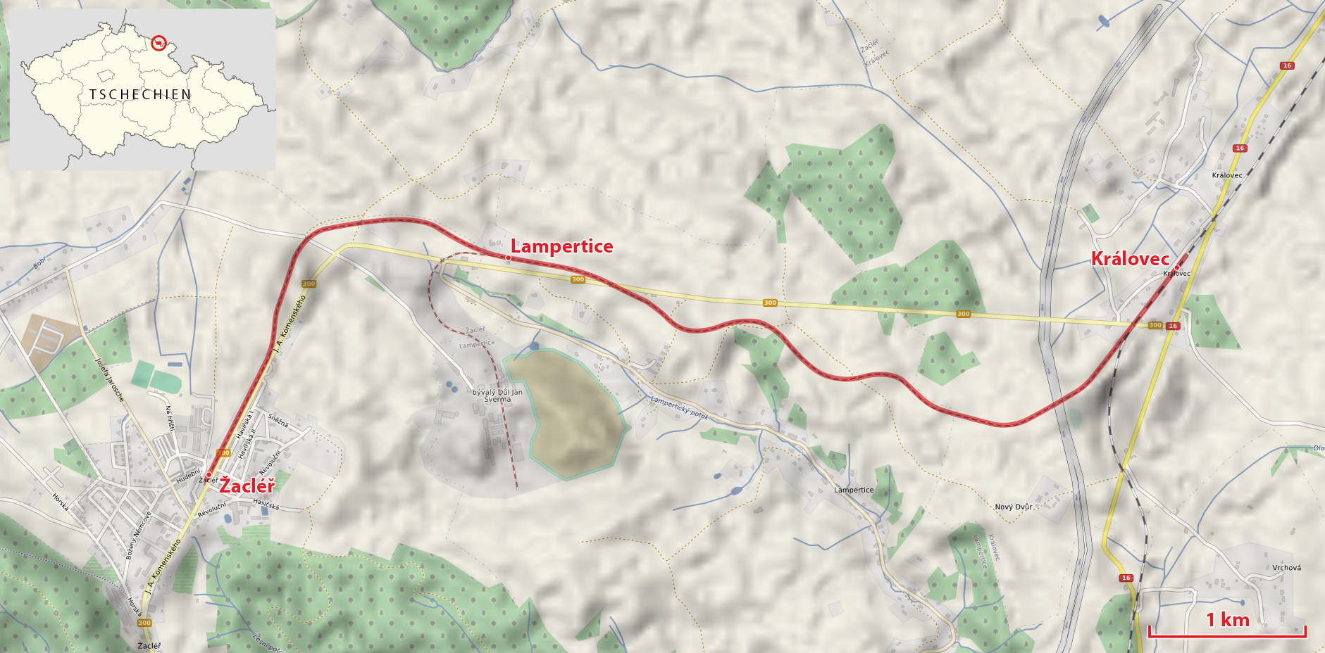
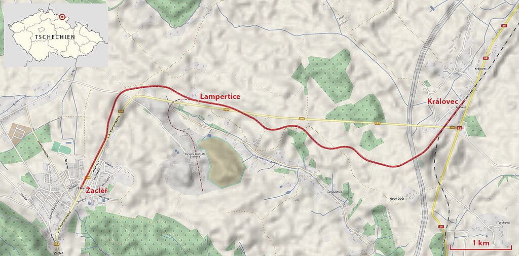
Deutsch: Karte der Bahnstrecke_Královec–Žacléř |
| Date | see file history |
| Source |
Own work, using
|
| Author | Maximilian Dörrbecker (Chumwa) |
| Permission (Reusing this file) |
All OpenStreetMap data and maps are Creative Commons "CC-BY-SA 2.0" licensed This file is licensed under the Creative Commons Attribution-Share Alike 2.0 Generic license.
|
File history
Click on a date/time to view the file as it appeared at that time.
| Date/Time | Thumbnail | Dimensions | User | Comment | |
|---|---|---|---|---|---|
| current | 05:48, 21 January 2014 | | 1,881 × 928 (525 KB) | Chumwa (talk | contribs) | |
| 08:16, 28 December 2013 |  | 1,881 × 928 (517 KB) | Chumwa (talk | contribs) | ||
| 08:04, 28 December 2013 |  | 1,881 × 928 (1.7 MB) | Chumwa (talk | contribs) | {{Information |Description={{de|Karte der Bahnstrecke_Královec–Žacléř}} |Author=Maximilian Dörrbecker (Chumwa) |Source={{own}}, using OpenStreetMap data for the background |Date=see file history |Permi... |
You cannot overwrite this file.
File usage on Commons
The following page uses this file:
File usage on other wikis
The following other wikis use this file:
- Usage on de.wikipedia.org