File:Karte der Kolonie Tauenzinow um 1773.png
Size of this preview: 800 × 402 pixels. Other resolutions: 320 × 161 pixels | 802 × 403 pixels.
Original file (802 × 403 pixels, file size: 370 KB, MIME type: image/png)
Captions
Captions
Add a one-line explanation of what this file represents
Summary edit
| Description |
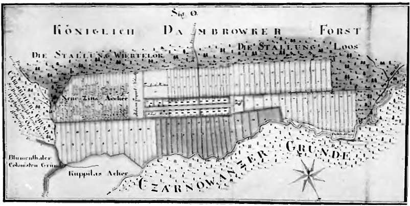
Deutsch: Karte der 1772 innerhalb der Friderizianischem Kolonisation gegründeten Kolonie Tauenzinow im Kreis Oppeln. |
| Date | |
| Source | Hans-Joachim Helmigk: Oberschlesische Landbaukunst um 1800. Verlag für Kunstwissenschaft, Berlin 1937. S. 190 |
| Author | Unbekannt, alte preußische Karte, erstellt um 1773. |
Licensing edit
This file is licensed under the Creative Commons Attribution-Share Alike 4.0 International license.
- You are free:
- to share – to copy, distribute and transmit the work
- to remix – to adapt the work
- Under the following conditions:
- attribution – You must give appropriate credit, provide a link to the license, and indicate if changes were made. You may do so in any reasonable manner, but not in any way that suggests the licensor endorses you or your use.
- share alike – If you remix, transform, or build upon the material, you must distribute your contributions under the same or compatible license as the original.
File history
Click on a date/time to view the file as it appeared at that time.
| Date/Time | Thumbnail | Dimensions | User | Comment | |
|---|---|---|---|---|---|
| current | 11:36, 30 January 2022 | | 802 × 403 (370 KB) | Io301 (talk | contribs) | Uploaded a work by Unbekannt, alte preußische Karte, erstellt um 1773. from Hans-Joachim Helmigk: Oberschlesische Landbaukunst um 1800. Verlag für Kunstwissenschaft, Berlin 1937. S. 190 with UploadWizard |
You cannot overwrite this file.
File usage on Commons
There are no pages that use this file.
File usage on other wikis
The following other wikis use this file:
- Usage on de.wikipedia.org