File:Karte plattengrenzen-nepal.png
Size of this preview: 800 × 480 pixels. Other resolutions: 320 × 192 pixels | 900 × 540 pixels.
Original file (900 × 540 pixels, file size: 103 KB, MIME type: image/png)
Captions
Captions
Add a one-line explanation of what this file represents
Summary edit
| Description |
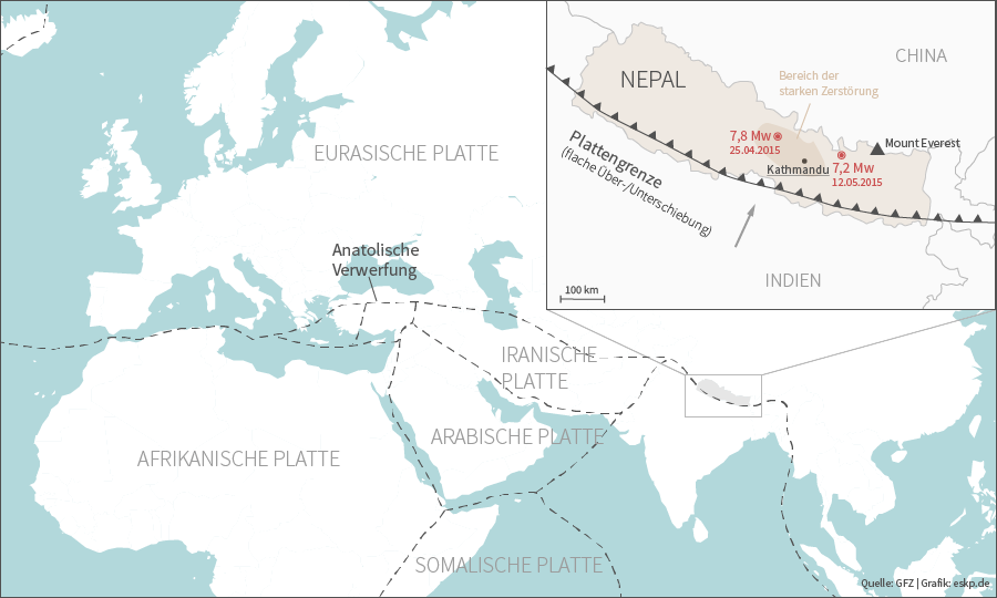
Deutsch: Am 25. April und 12. Mai 2015 wurde Nepal von schweren Erdbeben getroffen. Der Gebirgsstaat liegt an einer konvergenten Plattengrenze und ist dadurch erdbebengefährdet. Die Karte zeigt den Verlauf der Plattengrenzen sowie die Epizentren der Beben. |
| Date | |
| Source | Wissensplattform "Erde und Umwelt", www.eskp.de |
| Author | ESKP |
Licensing edit
This file is licensed under the Creative Commons Attribution 3.0 Unported license.
- You are free:
- to share – to copy, distribute and transmit the work
- to remix – to adapt the work
- Under the following conditions:
- attribution – You must give appropriate credit, provide a link to the license, and indicate if changes were made. You may do so in any reasonable manner, but not in any way that suggests the licensor endorses you or your use.
File history
Click on a date/time to view the file as it appeared at that time.
| Date/Time | Thumbnail | Dimensions | User | Comment | |
|---|---|---|---|---|---|
| current | 12:08, 22 May 2015 | | 900 × 540 (103 KB) | Geografik (talk | contribs) | User created page with UploadWizard |
You cannot overwrite this file.
File usage on Commons
There are no pages that use this file.
File usage on other wikis
The following other wikis use this file:
- Usage on de.wikipedia.org