File:Kathreinkogel Antike Höhensiedlung 8 Grundmauern Frühchristliche Kirche.jpg
Size of this preview: 552 × 600 pixels. Other resolutions: 221 × 240 pixels | 442 × 480 pixels | 707 × 768 pixels | 942 × 1,024 pixels | 1,884 × 2,048 pixels | 5,029 × 5,466 pixels.
Original file (5,029 × 5,466 pixels, file size: 12.52 MB, MIME type: image/jpeg)
Captions
Captions
Add a one-line explanation of what this file represents
| Description |
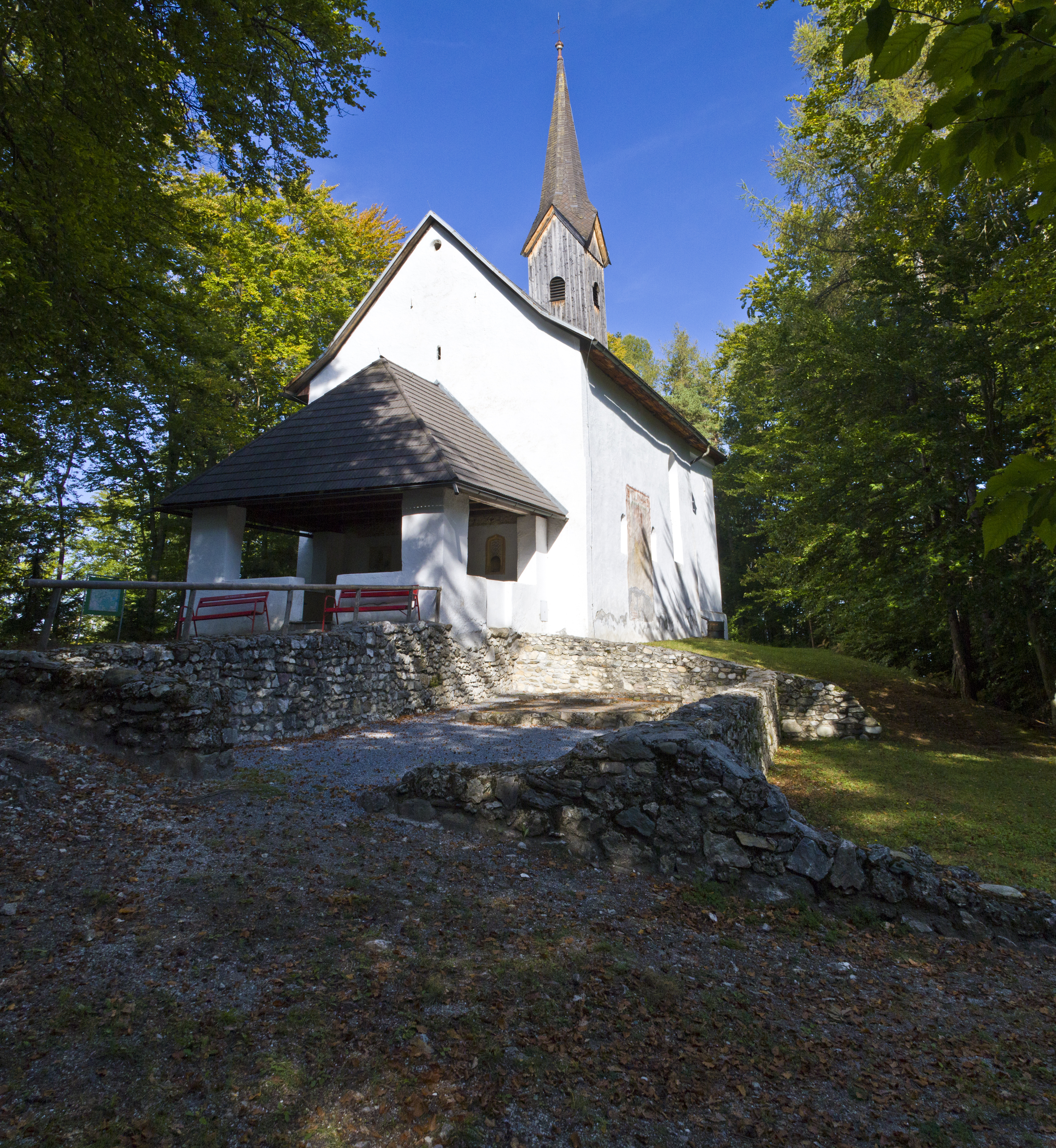
Deutsch: Spätantike Höhensiedlung Kathreinkogel. Grundmauern einer frühchristlichen Kirche neben der Kapelle.
|
| Date | |
| Source | Own work |
| Author | Nikolaus Lesnik |
| Object location | | View this and other nearby images on: OpenStreetMap |
|---|
This file is licensed under the Creative Commons Attribution 3.0 Austria license.
- You are free:
- to share – to copy, distribute and transmit the work
- to remix – to adapt the work
- Under the following conditions:
- attribution – You must give appropriate credit, provide a link to the license, and indicate if changes were made. You may do so in any reasonable manner, but not in any way that suggests the licensor endorses you or your use.


|
This image was uploaded as part of Wiki Loves Monuments 2011.
|
File history
Click on a date/time to view the file as it appeared at that time.
| Date/Time | Thumbnail | Dimensions | User | Comment | |
|---|---|---|---|---|---|
| current | 18:40, 29 September 2011 | | 5,029 × 5,466 (12.52 MB) | Nino3301 (talk | contribs) | {{Information |Description={{de|Spätantike Höhensiedlung Kathreinkogel. Grundmauern einer frühchristlichen Kirche neben der Kapelle.}} {{Denkmalgeschütztes Objekt Österreich|1=ArD-2-050}} |Source={{own}} |Date=2011-09-25 |Author=Nikolaus Lesnik |
You cannot overwrite this file.
File usage on Commons
The following page uses this file: