File:Keisei Yatsu Branch Trace.jpg

Size of this preview: 800 × 479 pixels. Other resolutions: 320 × 192 pixels | 640 × 383 pixels | 1,024 × 613 pixels | 1,505 × 901 pixels.
Original file (1,505 × 901 pixels, file size: 1.09 MB, MIME type: image/jpeg)
Captions
Captions
Add a one-line explanation of what this file represents
| Description |
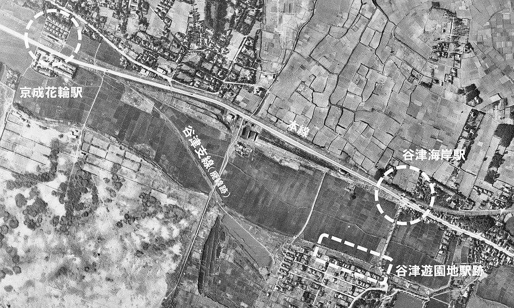
English: Abolished line trace of the Yatsu Branch. 日本語: 谷津支線廃線跡。 |
| Date | |
| Source |
|
| Author |
日本語: 国土地理院
|

|
The copyright holder of this file, Ministry of Land, Infrastructure, Transport and Tourism, allows anyone to use it for any purpose, provided that the copyright holder is properly attributed. Redistribution, derivative work, commercial use, and all other use is permitted. |
Attribution:
National Land Image Information (Color Aerial Photographs), created by Ministry of Land, Infrastructure, Transport and Tourism, distributed by Geospatial Information Authority of Japan
|

File history
Click on a date/time to view the file as it appeared at that time.
| Date/Time | Thumbnail | Dimensions | User | Comment | |
|---|---|---|---|---|---|
| current | 09:51, 24 December 2017 | | 1,505 × 901 (1.09 MB) | ButuCC (talk | contribs) | {{Information |description={{en|1=Abolished line trace of the Yatsu Branch.}}{{ja|1=谷津支線廃線跡。}} |date=1947-08-08 |source= *国土交通省「国土画像情報(カラー空中写真)」(配布元:国土地理院地図・空中写... |
You cannot overwrite this file.
File usage on Commons
The following 3 pages use this file: