File:Kenya topographic map-fr.svg

Size of this PNG preview of this SVG file: 575 × 599 pixels. Other resolutions: 230 × 240 pixels | 460 × 480 pixels | 737 × 768 pixels | 982 × 1,024 pixels | 1,965 × 2,048 pixels | 1,181 × 1,231 pixels.
Original file (SVG file, nominally 1,181 × 1,231 pixels, file size: 3.26 MB)
Captions
Captions
Add a one-line explanation of what this file represents
Summary edit
| Description |
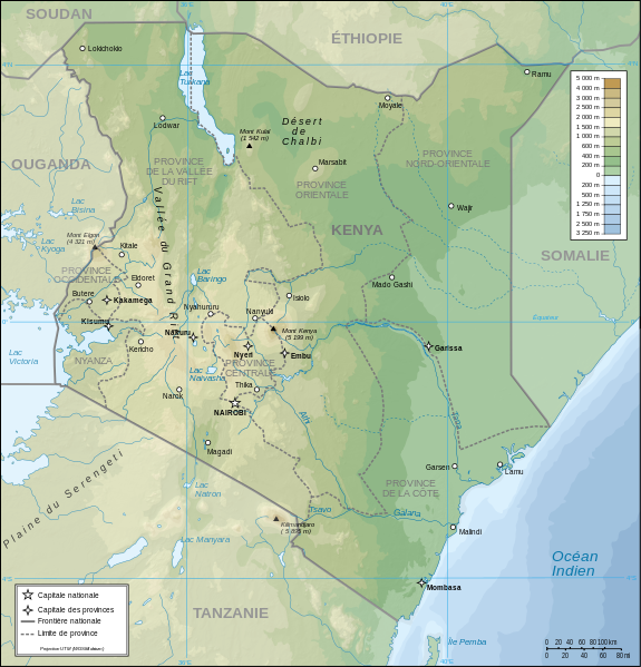
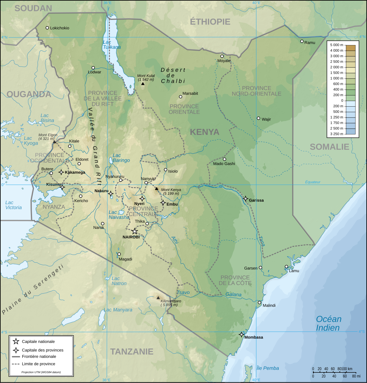
Français : Carte topographique du Kenya. Version française
English: Topographic map in French of Kenya |
| Date | |
| Source |
Own work (Original text: Own Work made with Inkscape From Topographic map : NASA Shuttle Radar Topography Mission (SRTM3 v.2) (public domain) edited with Global Mapper 9 from Visualization Software LLC and vectorized with Inkscape ; UTM projection ; WGS84 datum ; shaded relief (composite image of N-W, W and N lightning positions) ; Rivers, borders, cities : Demis add-on for World Wind ; Other references used : * NASA World Wind ; * File:Kenya-relief-map-towns.jpg ; Notes : The shaded relief is a raster image embedded in the SVG file which increases its size. If you want a lighter map for other purposes, delete the shaded relief image in your file.) |
| Author | Pinpin |
| Other versions |
Derivative works of this file: |
| SVG development |
| Camera location | | View this and other nearby images on: OpenStreetMap |
|---|
Licensing edit
I, the copyright holder of this work, hereby publish it under the following licenses:
| Copyleft: This work of art is free; you can redistribute it and/or modify it according to terms of the Free Art License. You will find a specimen of this license on the Copyleft Attitude site as well as on other sites. |
This file is licensed under the Creative Commons Attribution-Share Alike 4.0 International, 3.0 Unported, 2.5 Generic, 2.0 Generic and 1.0 Generic license.
- You are free:
- to share – to copy, distribute and transmit the work
- to remix – to adapt the work
- Under the following conditions:
- attribution – You must give appropriate credit, provide a link to the license, and indicate if changes were made. You may do so in any reasonable manner, but not in any way that suggests the licensor endorses you or your use.
- share alike – If you remix, transform, or build upon the material, you must distribute your contributions under the same or compatible license as the original.
You may select the license of your choice.
| Annotations | This image is annotated: View the annotations at Commons |
File history
Click on a date/time to view the file as it appeared at that time.
| Date/Time | Thumbnail | Dimensions | User | Comment | |
|---|---|---|---|---|---|
| current | 19:48, 14 August 2023 | | 1,181 × 1,231 (3.26 MB) | Sémhur (talk | contribs) | Correction des latitudes et longitudes |
| 10:00, 30 April 2008 |  | 1,181 × 1,231 (3.28 MB) | Sémhur (talk | contribs) | Orthograph : provence => province | |
| 19:48, 7 April 2008 |  | 1,181 × 1,231 (3.28 MB) | Pinpin (talk | contribs) | == Description == {{Information |Description={{fr|Carte topographique du Kenya. Version française}} {{en|Topographic map in French of Kenya}} |Source=Own Work made with Inkscape From <br/>Topographic map : [http://www2.jpl.nasa.gov/srtm NASA Shuttle Rada |
You cannot overwrite this file.
File usage on Commons
The following 5 pages use this file:
File usage on other wikis
The following other wikis use this file:
- Usage on avk.wikipedia.org
- Usage on ca.wikipedia.org
- Usage on de.wikipedia.org
- Usage on en.wikipedia.org
- Usage on es.wikipedia.org
- Usage on fr.wikipedia.org
- Usage on nl.wikipedia.org
- Usage on ps.wikipedia.org
- Usage on ru.wikipedia.org
- Usage on uk.wikipedia.org