File:Kill-Van-Kull-map.svg

Size of this PNG preview of this SVG file: 562 × 600 pixels. Other resolutions: 225 × 240 pixels | 450 × 480 pixels | 720 × 768 pixels | 960 × 1,024 pixels | 1,919 × 2,048 pixels | 687 × 733 pixels.
Original file (SVG file, nominally 687 × 733 pixels, file size: 340 KB)
Captions
Captions
Add a one-line explanation of what this file represents
Summary edit
| Description |
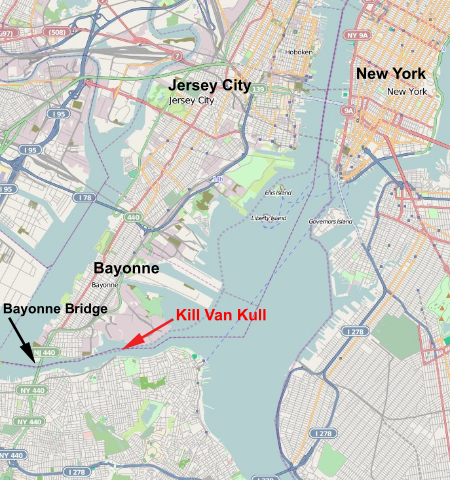
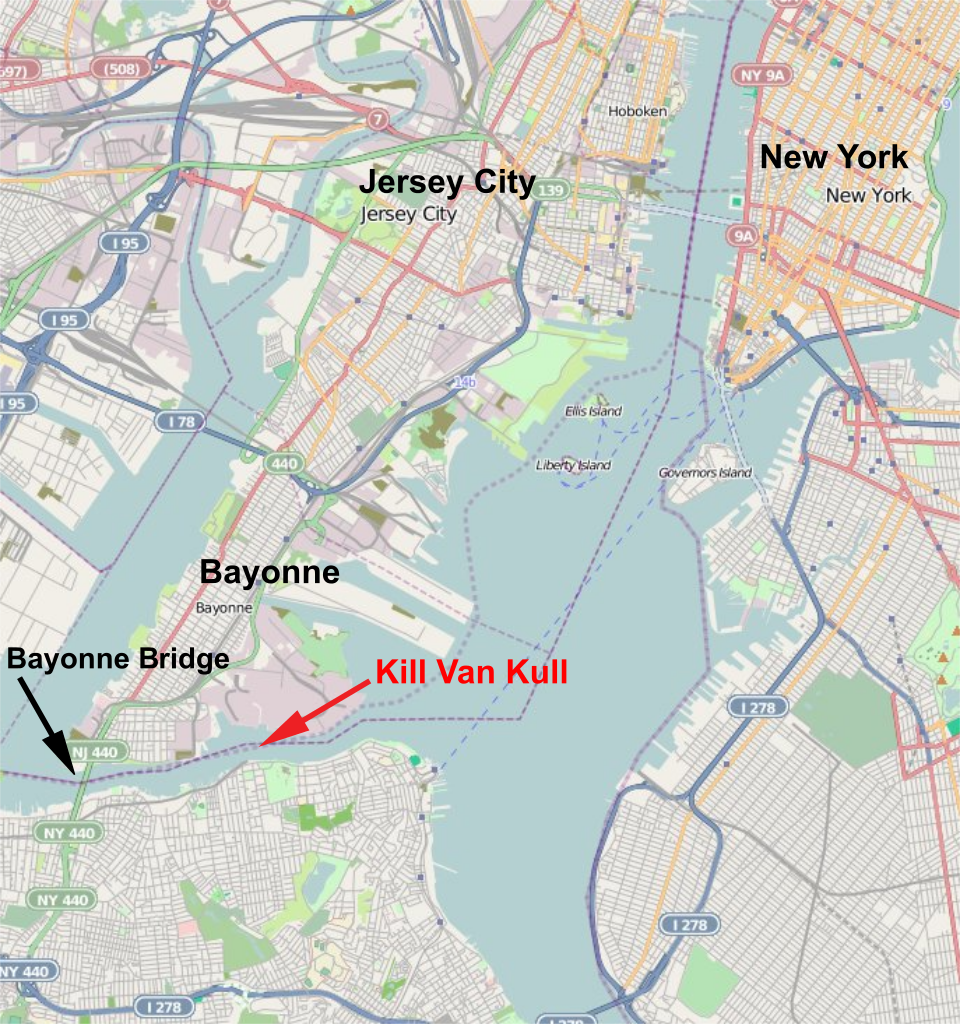
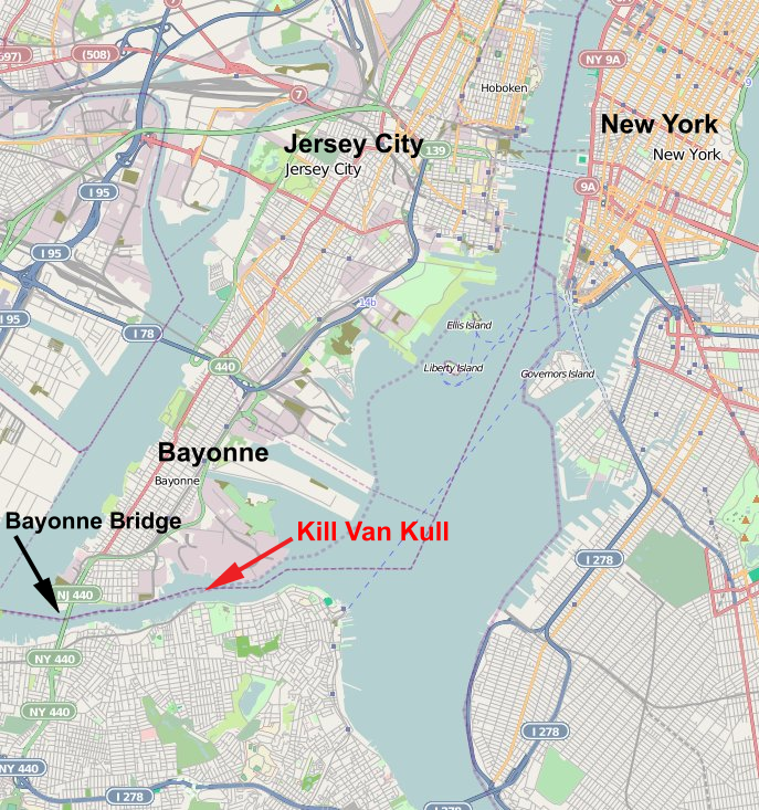
This map of Kill Van Kull narrows was created from OpenStreetMap project data, collected by the community. This map may be incomplete, and may contain errors. Don't rely solely on it for navigation. |
| Date | (see file history) |
| Source | openstreetmap.org |
| Creator |
OpenStreetMap contributors |
| Permission (Reusing this file) |
OpenStreetMap data and maps are licensed under the Creative Commons Attribution-ShareAlike 2.0 license (CC-BY-SA 2.0). This file is licensed under the Creative Commons Attribution-Share Alike 2.0 Generic license.
|
| Georeferencing | If inappropriate please set warp_status = skip to hide. |
This map was created with Adobe Illustrator.
File history
Click on a date/time to view the file as it appeared at that time.
| Date/Time | Thumbnail | Dimensions | User | Comment | |
|---|---|---|---|---|---|
| current | 21:11, 28 May 2014 | | 687 × 733 (340 KB) | Hydrargyrum (talk | contribs) | correct capitalization |
| 10:16, 13 December 2009 |  | 687 × 733 (331 KB) | Roulex 45 (talk | contribs) | {{OpenStreetMap |source=http://www.openstreetmap.org/?lat=40.68545&lon=-74.08330000000001&zoom=11&layers=B00FTFT |location=Kill Van Kull narrows }} <!--{{ImageUpload|basic}}--> {{SVG|map}} |
You cannot overwrite this file.
File usage on Commons
There are no pages that use this file.
File usage on other wikis
The following other wikis use this file:
- Usage on de.wikipedia.org
- Usage on en.wikipedia.org
- Usage on es.wikipedia.org
- Usage on it.wikipedia.org
- Usage on nl.wikipedia.org
- Usage on pt.wikipedia.org