File:King's Highway.svg

Size of this PNG preview of this SVG file: 251 × 509 pixels. Other resolutions: 118 × 240 pixels | 236 × 480 pixels | 378 × 768 pixels | 505 × 1,024 pixels | 1,010 × 2,048 pixels.
Original file (SVG file, nominally 251 × 509 pixels, file size: 135 KB)
Captions
Captions
Add a one-line explanation of what this file represents
Summary edit
| Description |
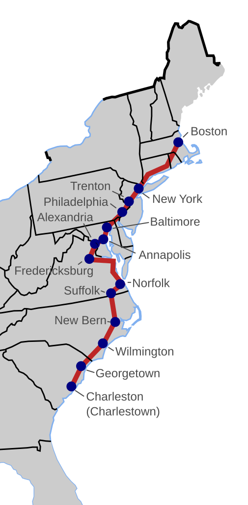
English: This is a map of the King's Highway. The state boundaries shown are the modern borders. The map was derived from this sketch and the places listed in the English Wikipedia article. File:Blank_US_Map_with_borders.svg was used for the blank map.
This W3C-unspecified vector image was created with Inkscape . |
| Date | |
| Source | Own work |
| Author | TastyCakes |
.jpg)
Licensing edit
| I, the copyright holder of this work, release this work into the public domain. This applies worldwide. In some countries this may not be legally possible; if so: I grant anyone the right to use this work for any purpose, without any conditions, unless such conditions are required by law. |
File history
Click on a date/time to view the file as it appeared at that time.
| Date/Time | Thumbnail | Dimensions | User | Comment | |
|---|---|---|---|---|---|
| current | 20:15, 28 August 2009 | | 251 × 509 (135 KB) | TastyCakes (talk | contribs) | {{Information |Description={{en|1=This is a map of the King's Highway. The state boundaries shown are the modern borders. The map was derived from this sketch and the places listed in the English Wikip |
You cannot overwrite this file.
File usage on Commons
The following page uses this file:
File usage on other wikis
The following other wikis use this file:
- Usage on en.wikipedia.org
- Usage on ja.wikipedia.org