File:Kislaya Guba map rus.png

Size of this preview: 513 × 599 pixels. Other resolutions: 205 × 240 pixels | 411 × 480 pixels | 1,000 × 1,168 pixels.
Original file (1,000 × 1,168 pixels, file size: 428 KB, MIME type: image/png)
Captions
Captions
Add a one-line explanation of what this file represents
| Description |
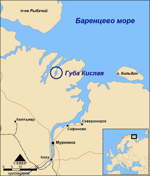
English: Map showing the location of the Kislaya Guba tidal power project in the Kola Peninsula, Russia. Русский: Карта показывает местоположение Кислой губы |
| Date | |
| Source | Image:Kislaya Guba map.png |
| Author | ru:user:Insider(in Russian). Original created by NormanEinstein, June 13, 2006. |
| Other versions |
 |
| I, the copyright holder of this work, release this work into the public domain. This applies worldwide. In some countries this may not be legally possible; if so: I grant anyone the right to use this work for any purpose, without any conditions, unless such conditions are required by law. |
File history
Click on a date/time to view the file as it appeared at that time.
| Date/Time | Thumbnail | Dimensions | User | Comment | |
|---|---|---|---|---|---|
| current | 00:15, 17 April 2008 | | 1,000 × 1,168 (428 KB) | Insider (talk | contribs) | {{Information |Description={{en|Map showing the location of the Kislaya Guba tidal power project in the Kola Peninsula, Russia.}}{{ru|Карта показывает местоположение Кислой губы}} |Source=[[Image:Kislaya Guba map.png |
You cannot overwrite this file.
File usage on Commons
There are no pages that use this file.
File usage on other wikis
The following other wikis use this file:
- Usage on it.wikipedia.org
- Usage on ru.wikipedia.org