File:KitaAsahikawa kamotsu-eki.jpg

Size of this preview: 790 × 599 pixels. Other resolutions: 317 × 240 pixels | 633 × 480 pixels | 1,013 × 768 pixels | 1,280 × 971 pixels | 2,436 × 1,848 pixels.
Original file (2,436 × 1,848 pixels, file size: 4.82 MB, MIME type: image/jpeg)
Captions
Captions
Add a one-line explanation of what this file represents
Summary edit
| Description |
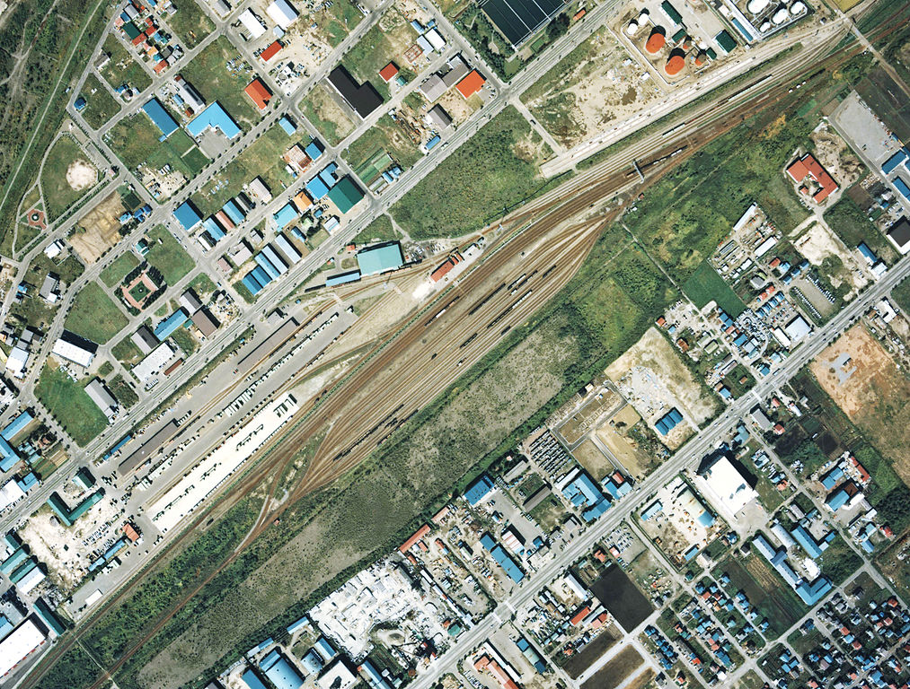
English: Soya Main Line Kita-Asahikawa Freight Terminal in 1977.
日本語: 宗谷本線 北旭川(貨物)駅 1977年。周囲約1.5km×1km範囲。右上が名寄方面。この頃は形式上一般駅であった。左にコンテナターミナル、南東側には大きな操作場があって、旭川運転所の建物はまだない。 |
| Date | |
| Source |
English: Ministry of Land, Infrastructure, Transport and Tourism of Japan 日本語: 国土交通省 |
| Author | Nisanyongo |
Licensing edit

|
The copyright holder of this file, the Ministry of Land, Infrastructure, Transport and Tourism of Japan, allows anyone to use it for any purpose, provided that the copyright holder is properly attributed. Redistribution, derivative work, commercial use, and all other use is permitted. |
Attribution:
Copyright © National Land Image Information (Color Aerial Photographs), Ministry of Land, Infrastructure, Transport and Tourism
|
 |
This image is copyrighted by the Ministry of Land, Infrastructure, Transport and Tourism of Japan. For terms of use, see the stipulation to use of National Land Information (in Japanese) and message from MLIT (in Japanese and English). When you display this image on an article, include the following phrase in the description: "Made based on National Land Image Information (Color Aerial Photographs), Ministry of Land, Infrastructure, Transport and Tourism".
|
File history
Click on a date/time to view the file as it appeared at that time.
| Date/Time | Thumbnail | Dimensions | User | Comment | |
|---|---|---|---|---|---|
| current | 09:22, 27 May 2015 | | 2,436 × 1,848 (4.82 MB) | Nisanyongo (talk | contribs) | adjust of color |
| 09:30, 10 March 2013 |  | 2,436 × 1,848 (3.15 MB) | Nisanyongo (talk | contribs) | adjust of color | |
| 20:09, 8 January 2010 |  | 2,436 × 1,848 (1.96 MB) | Nisanyongo (talk | contribs) | {{Information |Description={{en|1=Soya Main Line Kita-Asahikawa Freight Terminal 1977.}} {{ja|1=宗谷本線北旭川(貨物)駅 1977年。周囲約1.5km×1km範囲。右上が名寄方面。この頃は形式上一般駅であった。中央左にコ |
You cannot overwrite this file.
File usage on Commons
The following 2 pages use this file:
File usage on other wikis
The following other wikis use this file:
- Usage on de.wikipedia.org
- Usage on ja.wikipedia.org
- Usage on www.wikidata.org