File:KitamiEsashi eki.jpg
Size of this preview: 600 × 600 pixels. Other resolutions: 240 × 240 pixels | 480 × 480 pixels | 768 × 768 pixels | 1,240 × 1,240 pixels.
Original file (1,240 × 1,240 pixels, file size: 2.43 MB, MIME type: image/jpeg)
Captions
Captions
Add a one-line explanation of what this file represents
Summary
edit
| Description |
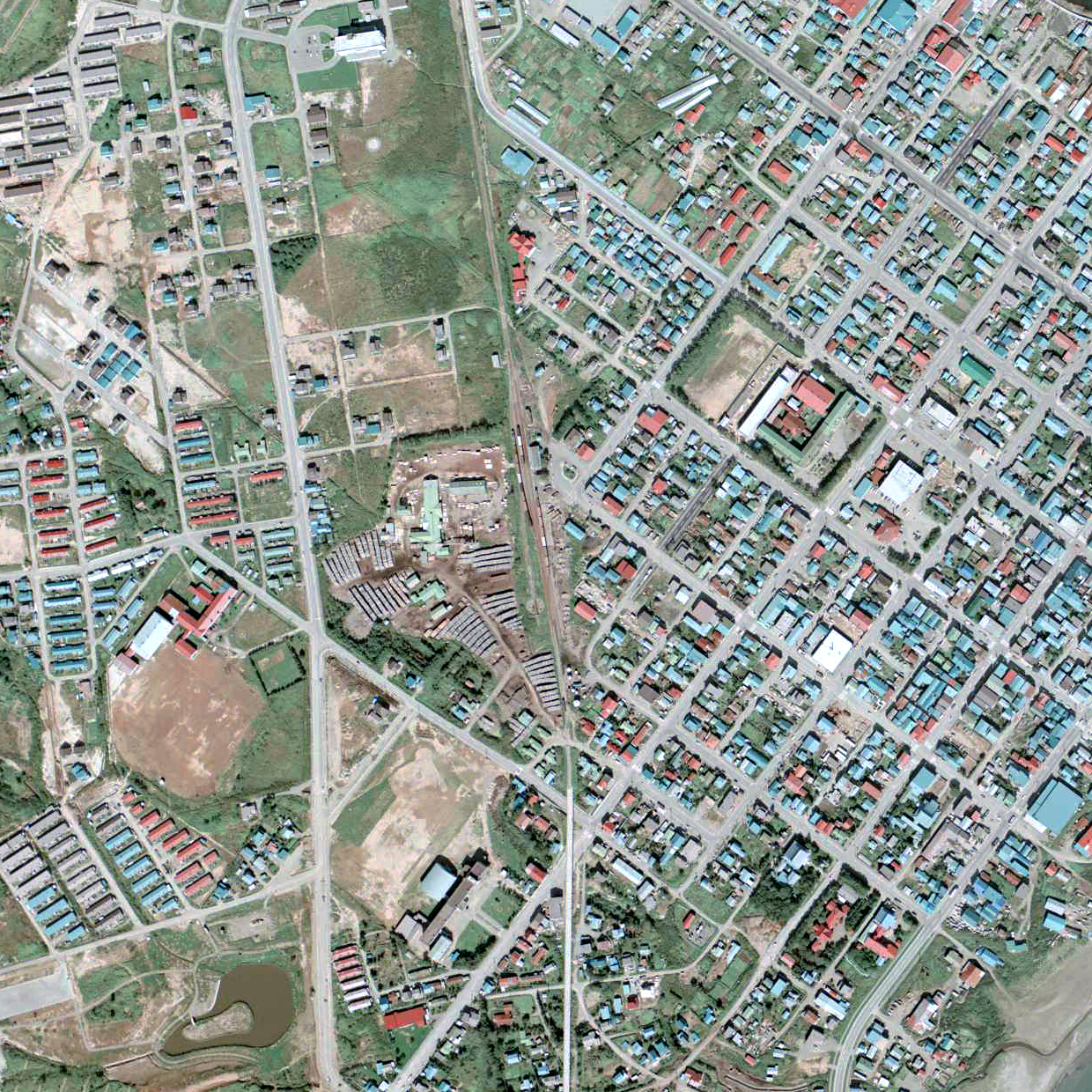
English: Kitami-Esashi railway station and surroundings in 1977
日本語: 興浜北線(廃線)北見枝幸駅 1977年。周囲約500m×750m範囲。上が浜頓別方面。 |
| Date | |
| Source |
English: Ministry of Land, Infrastructure, Transport and Tourism of Japan 日本語: 国土交通省 |
| Author | Nisanyongo |
Licensing
edit

|
The copyright holder of this file, the Ministry of Land, Infrastructure, Transport and Tourism of Japan, allows anyone to use it for any purpose, provided that the copyright holder is properly attributed. Redistribution, derivative work, commercial use, and all other use is permitted. |
Attribution:
Copyright © National Land Image Information (Color Aerial Photographs), Ministry of Land, Infrastructure, Transport and Tourism
|
 |
This image is copyrighted by the Ministry of Land, Infrastructure, Transport and Tourism of Japan. For terms of use, see the stipulation to use of National Land Information (in Japanese) and message from MLIT (in Japanese and English). When you display this image on an article, include the following phrase in the description: "Made based on National Land Image Information (Color Aerial Photographs), Ministry of Land, Infrastructure, Transport and Tourism".
|
File history
Click on a date/time to view the file as it appeared at that time.
| Date/Time | Thumbnail | Dimensions | User | Comment | |
|---|---|---|---|---|---|
| current | 09:40, 31 July 2017 | | 1,240 × 1,240 (2.43 MB) | Voyager (talk | contribs) | == {{int:filedesc}} == {{Information |Description={{en|Kitami-Esashi railway station and surroundings in 1977}} {{ja|興浜北線(廃線)北見枝幸駅 1977年。周囲約500m×750m範囲。上が浜頓別方面。}} |Source={{en|Ministry of Land,... |
| 01:02, 15 April 2015 |  | 1,240 × 1,240 (2.43 MB) | Nisanyongo (talk | contribs) | 1km四方に範囲拡大 | |
| 12:06, 2 February 2010 |  | 620 × 930 (542 KB) | Nisanyongo (talk | contribs) | {{Information |Description=興浜北線(廃線)北見枝幸駅 1977年。周囲約500m×750m範囲。上が浜頓別方面。 |Source={{国土航空写真}} |Date=2010/2/1 |Author=Nisanyongo |Permission=下記を参照して下さい |other_versions= |
You cannot overwrite this file.
File usage on Commons
The following 3 pages use this file:
File usage on other wikis
The following other wikis use this file:
- Usage on de.wikipedia.org
- Usage on ja.wikipedia.org
- Usage on www.wikidata.org
- Usage on zh.wikipedia.org