File:Klausenpass-passstraße12.jpg
Size of this preview: 800 × 581 pixels. Other resolutions: 320 × 232 pixels | 640 × 465 pixels | 1,024 × 743 pixels | 1,280 × 929 pixels | 2,244 × 1,629 pixels.
Original file (2,244 × 1,629 pixels, file size: 2.93 MB, MIME type: image/jpeg)
Captions
Captions
Add a one-line explanation of what this file represents
Summary edit
| Description |
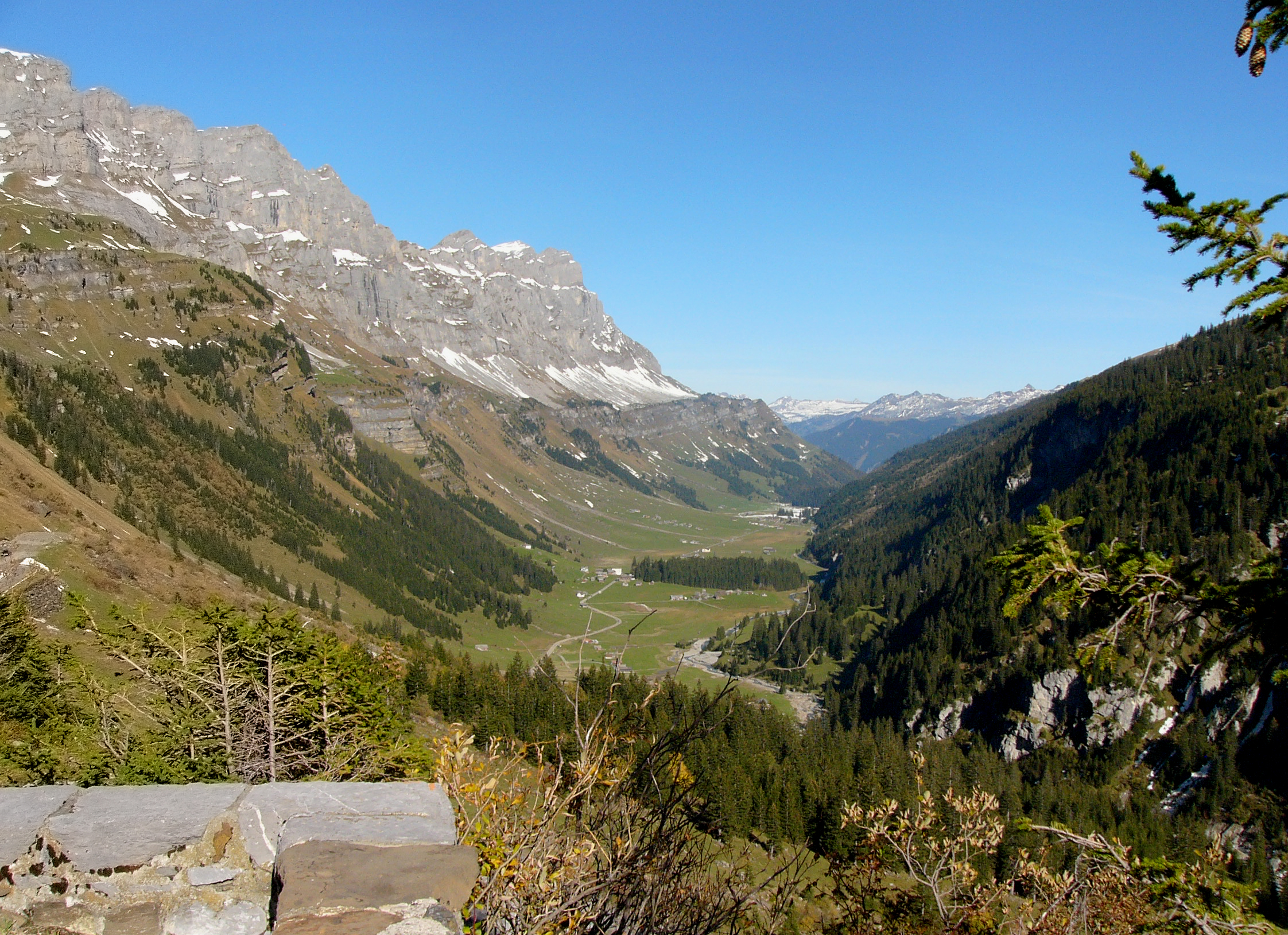
Deutsch: Der Klausenpass (Passhöhe auf 1948 m) ist ein Pass in der Schweiz, der die Kantone Uri und Glarus verbindet. Im Bild: Blick ostwärts vom oberen Ende des Urnerbodens, im Hintergrund der Jegerstock (2573 m) und der Ortstock (2717 m). English: Klausen Pass (el. 1948 m.) is a high mountain pass in the Swiss Alps connecting the cantons of Uri and Glarus. View to the Urnerboden on the eastside. |
| Date | |
| Source | Own work |
| Author | Nikater |
| Permission (Reusing this file) |
Own work, all rights released (Public domain) |
| Camera location | | View this and other nearby images on: OpenStreetMap |
|---|
Licensing edit
| I, the copyright holder of this work, release this work into the public domain. This applies worldwide. In some countries this may not be legally possible; if so: I grant anyone the right to use this work for any purpose, without any conditions, unless such conditions are required by law. |
File history
Click on a date/time to view the file as it appeared at that time.
| Date/Time | Thumbnail | Dimensions | User | Comment | |
|---|---|---|---|---|---|
| current | 21:34, 4 December 2011 | | 2,244 × 1,629 (2.93 MB) | Nikater (talk | contribs) | {{Information |Description= {{de| Der Klausenpass (Passhöhe auf 1948 m) ist ein Pass in der Schweiz, der die Kantone Uri und Glarus verbindet. '''Im Bild''': Blick ostwärts vom oberen Ende des Urnerbodens, im Hinte |
You cannot overwrite this file.
File usage on Commons
There are no pages that use this file.