File:Koblenz Evakuierung 4-12-2011.png
Size of this preview: 711 × 599 pixels. Other resolutions: 285 × 240 pixels | 569 × 480 pixels | 911 × 768 pixels | 1,215 × 1,024 pixels | 1,688 × 1,423 pixels.
Original file (1,688 × 1,423 pixels, file size: 857 KB, MIME type: image/png)
Captions
Captions
Add a one-line explanation of what this file represents
Summary edit
| Description |
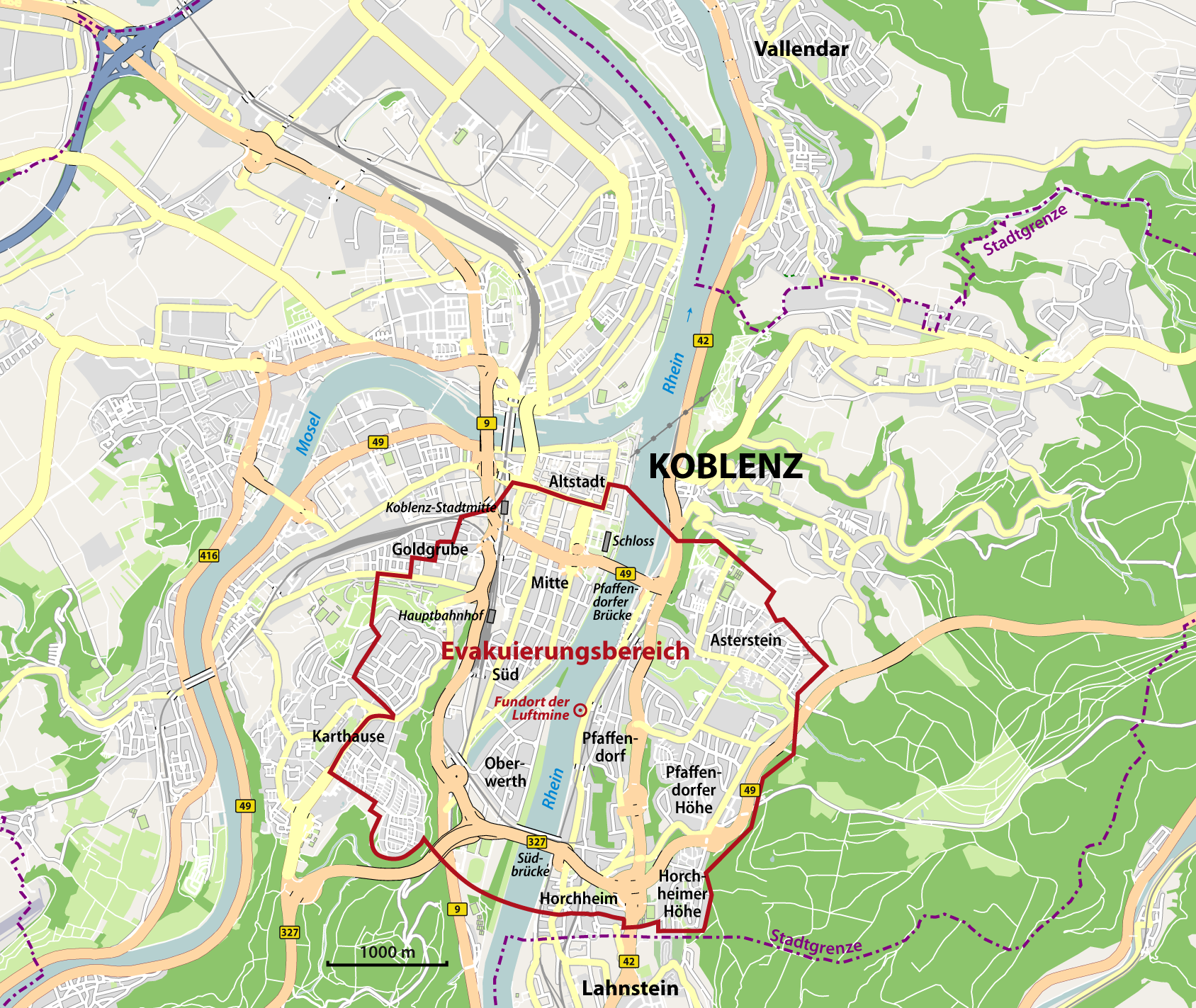
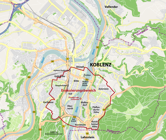
Deutsch: Evakuierung in Koblenz am 4. Dezember 2011: Evakuierungsbereich in Koblenz zur Entschärfung von Fliegerbomben |
||||||||||||
| Date | |||||||||||||
| Source |
|
||||||||||||
| Author | NordNordWest | ||||||||||||
| Permission (Reusing this file) |
|

|
This map has been made or improved in the German Kartenwerkstatt (Map Lab). You can propose maps to improve as well.
|
File history
Click on a date/time to view the file as it appeared at that time.
| Date/Time | Thumbnail | Dimensions | User | Comment | |
|---|---|---|---|---|---|
| current | 15:53, 10 December 2011 | | 1,688 × 1,423 (857 KB) | NordNordWest (talk | contribs) | upd |
| 12:27, 28 November 2011 |  | 1,688 × 1,423 (856 KB) | NordNordWest (talk | contribs) | ergänzt | |
| 11:17, 27 November 2011 |  | 1,688 × 1,423 (836 KB) | NordNordWest (talk | contribs) | == {{int:filedesc}} == {{Information |Description= {{de|Evakuierungsbereich am 4. Dezember 2011 in Koblenz zur Entschärfung von Fliegerbomben}} |Source=* OpenStreetMap * [http://www.rhein-zeitung.de/cms_media/module_ob/1/586_1_2011_11_22_Karte_Evakuieru |
You cannot overwrite this file.
File usage on Commons
The following page uses this file:
File usage on other wikis
The following other wikis use this file:
- Usage on de.wikipedia.org
- Usage on de.wikinews.org