File:KreisBC StadtBadSchussenried.jpg

Size of this preview: 800 × 481 pixels. Other resolutions: 320 × 193 pixels | 640 × 385 pixels | 854 × 514 pixels.
Original file (854 × 514 pixels, file size: 60 KB, MIME type: image/jpeg)
Captions
Captions
Add a one-line explanation of what this file represents

|
This locator map image could be re-created using vector graphics as an SVG file. This has several advantages; see Commons:Media for cleanup for more information. If an SVG form of this image is available, please upload it and afterwards replace this template with
{{vector version available|new image name}}.
It is recommended to name the SVG file “KreisBC StadtBadSchussenried.svg”—then the template Vector version available (or Vva) does not need the new image name parameter. |

Summary edit
| Description |
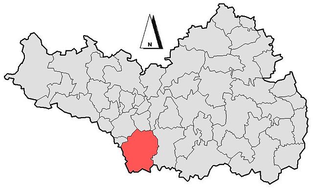
Deutsch: Maßstabsgetreues Schema der Lage der Stadt Bad Schussenried im Landkreis Biberach. |
| Date | |
| Source | Own work |
| Author | Kauk0r |
Licensing edit
| I, the copyright holder of this work, release this work into the public domain. This applies worldwide. In some countries this may not be legally possible; if so: I grant anyone the right to use this work for any purpose, without any conditions, unless such conditions are required by law. |
File history
Click on a date/time to view the file as it appeared at that time.
| Date/Time | Thumbnail | Dimensions | User | Comment | |
|---|---|---|---|---|---|
| current | 18:14, 30 March 2009 | | 854 × 514 (60 KB) | Kauk0r (talk | contribs) | Fehlerhafte Digitalisierung verbessert, Gemeindegrenzen und Nordpfeil hinzugefügt |
| 18:20, 23 August 2008 |  | 512 × 288 (12 KB) | Kauk0r (talk | contribs) | {{Information |Description={{de|1=Maßstabsgetreues Schema der Lage der Stadt Bad Schussenried im Landkreis Biberach.}} |Source=Own work by uploader |Author=Kauk0r |Date=23.08.2008 |Permission= |other_versions= }} <!--{{ImageUpload|full}} |
You cannot overwrite this file.
File usage on Commons
The following page uses this file:
File usage on other wikis
The following other wikis use this file:
- Usage on azb.wikipedia.org
- Usage on pt.wikipedia.org