File:Kreuzkirchle Info.jpg
Size of this preview: 277 × 599 pixels. Other resolutions: 111 × 240 pixels | 462 × 999 pixels.
Original file (462 × 999 pixels, file size: 382 KB, MIME type: image/jpeg)
Captions
Captions
Add a one-line explanation of what this file represents
Summary edit
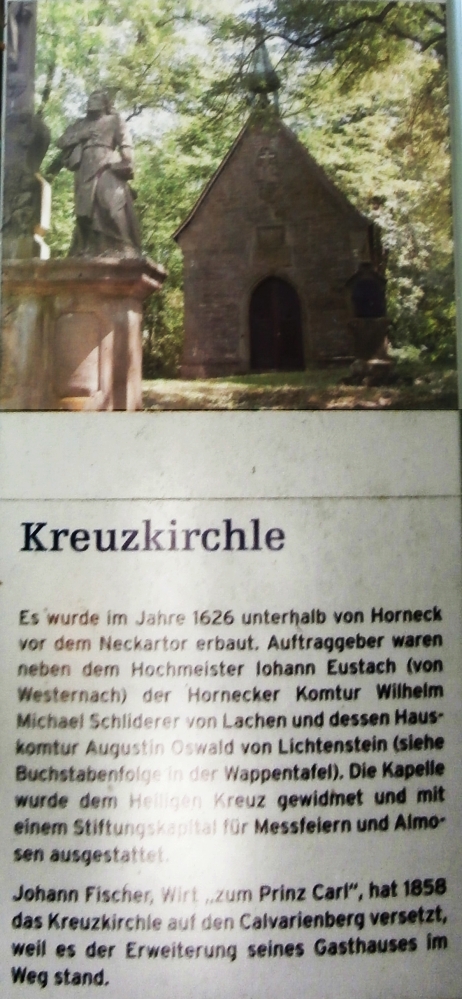
| Description | Kreuzkirchle Info | ||
| Date | |||
| Source | Own work | ||
| Author | Sarang | ||
| Permission (Reusing this file) |
|
| Object location | | View this and other nearby images on: OpenStreetMap |
|---|
File history
Click on a date/time to view the file as it appeared at that time.
| Date/Time | Thumbnail | Dimensions | User | Comment | |
|---|---|---|---|---|---|
| current | 10:18, 12 June 2023 | | 462 × 999 (382 KB) | Sarang (talk | contribs) | == {{int:filedesc}} == {{Inform | date = 2023-06-11 | auth = Sarang | oloc = 49°17′24.5″N 09°09′46.8″E/dim:160 }} Category:Calvarienberg in Gundelsheim Category:Information boards in Landkreis Heilbronn |
You cannot overwrite this file.
File usage on Commons
The following page uses this file: