File:Kurdistan 2009.png
Size of this preview: 666 × 600 pixels. Other resolutions: 267 × 240 pixels | 533 × 480 pixels | 853 × 768 pixels | 1,106 × 996 pixels.
Original file (1,106 × 996 pixels, file size: 669 KB, MIME type: image/png)
Captions
Captions
Add a one-line explanation of what this file represents
Summary edit
| Description |
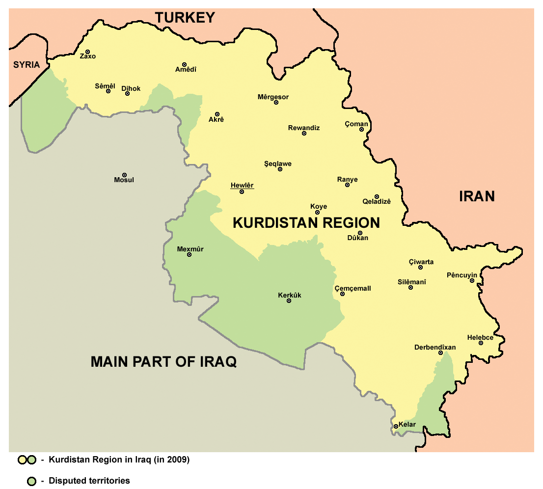
English: Map of Kurdistan Region in Iraq in 2009, including the disputed territories (Kirkuk with its province and other). |
| Date | |
| Source | Own work |
| Author | PANONIAN |
Licensing edit
I, the copyright holder of this work, hereby publish it under the following license:
| This file is made available under the Creative Commons CC0 1.0 Universal Public Domain Dedication. | |
| The person who associated a work with this deed has dedicated the work to the public domain by waiving all of their rights to the work worldwide under copyright law, including all related and neighboring rights, to the extent allowed by law. You can copy, modify, distribute and perform the work, even for commercial purposes, all without asking permission.
|
References edit
- Source for this map is this publication: http://www.krg.org/uploads/documents/invest_in_kurdistan_2009.pdf (The Kurdistan Region - invest in the future, an official publication of the Kurdistan Regional Government, 2009) - map of Kurdistan Region that was used as a source is published on page 160 of that publication.
- Same map in other source: http://www.marefa.org/images/a/ac/South_Kurdistan.png
File history
Click on a date/time to view the file as it appeared at that time.
| Date/Time | Thumbnail | Dimensions | User | Comment | |
|---|---|---|---|---|---|
| current | 14:24, 10 August 2014 | | 1,106 × 996 (669 KB) | PANONIAN (talk | contribs) | more cities |
| 08:59, 14 June 2012 |  | 1,106 × 996 (660 KB) | PANONIAN (talk | contribs) | {{Information |Description ={{en|1=Kurdistan region in Iraq in 2009, including the disputed territories.}} |Source ={{own}} |Author =PANONIAN |Date =2012 |Permission = |other_versions = }} |
You cannot overwrite this file.
File usage on Commons
The following 2 pages use this file:
File usage on other wikis
The following other wikis use this file:
- Usage on ast.wikipedia.org
- Usage on br.wikipedia.org
- Usage on bs.wikipedia.org
- Usage on ca.wikipedia.org
- Usage on ceb.wikipedia.org
- Usage on cs.wikipedia.org
- Usage on da.wikipedia.org
- Usage on el.wikipedia.org
- Usage on eo.wikipedia.org
- Usage on es.wikipedia.org
- Usage on fa.wikipedia.org
- Usage on hy.wikipedia.org
- Usage on ja.wikipedia.org
- Usage on ko.wikipedia.org
- Usage on ku.wikipedia.org
- Usage on ms.wikipedia.org
- Usage on nl.wikipedia.org
- Usage on pl.wikipedia.org
- Usage on ru.wikinews.org
- Usage on sh.wikipedia.org
- Usage on simple.wikipedia.org
- Usage on sr.wikipedia.org
- Usage on su.wikipedia.org
- Usage on ta.wikipedia.org
- Usage on tr.wikipedia.org
- Usage on uk.wikipedia.org