File:Kurdistan 2012.png

Size of this preview: 666 × 600 pixels. Other resolutions: 267 × 240 pixels | 533 × 480 pixels | 853 × 768 pixels | 1,106 × 996 pixels.
Original file (1,106 × 996 pixels, file size: 595 KB, MIME type: image/png)
Captions
Captions
Add a one-line explanation of what this file represents
Summary edit
| Description |
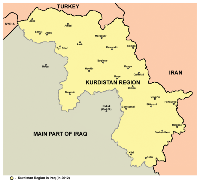
English: Map of Kurdistan Region in Iraq in 2012. |
| Date | |
| Source | Own work |
| Author | PANONIAN |
Licensing edit
I, the copyright holder of this work, hereby publish it under the following license:
| This file is made available under the Creative Commons CC0 1.0 Universal Public Domain Dedication. | |
| The person who associated a work with this deed has dedicated the work to the public domain by waiving all of their rights to the work worldwide under copyright law, including all related and neighboring rights, to the extent allowed by law. You can copy, modify, distribute and perform the work, even for commercial purposes, all without asking permission.
|
Refences edit
Borders of Kurdistan are made in accordance with these maps provided by the Kurdistan Region Statistics Office:
- http://www.krso.net/en/maps
- http://www.krso.net/documents/78/SubDistricts%20of%20the%20Governorates%20of%20Kurdistan%20Region.jpg
- http://www.krso.net/documents/38/Districts%20of%20the%20Governorates%20of%20Kurdistan%20Region.jpg
- http://www.krso.net/pdf/KRG-map-english.jpg
Sources for main cities and towns in the region:
- http://krso.site.aplus.net/oldsite/images/Dohuk2.jpg
- http://krso.site.aplus.net/oldsite/images/hewlir2.jpg
- http://krso.site.aplus.net/oldsite/images/Solaymaney2.jpg
- http://z5.ifrm.com/30192/69/0/p1104548/IraqKurdistan_2003_2005_lg.gif
- http://hdtravelpictures.com/wp-content/uploads/2011/03/221.gif
File history
Click on a date/time to view the file as it appeared at that time.
| Date/Time | Thumbnail | Dimensions | User | Comment | |
|---|---|---|---|---|---|
| current | 12:21, 10 August 2014 | | 1,106 × 996 (595 KB) | PANONIAN (talk | contribs) | correction |
| 11:04, 9 August 2014 |  | 1,106 × 996 (595 KB) | PANONIAN (talk | contribs) | {{Information |Description ={{en|1=Map of Kurdistan Region in Iraq in 2012.}} |Source ={{own}} |Author =PANONIAN |Date =2014 |Permission = |other_versions = }} |
You cannot overwrite this file.
File usage on Commons
The following 2 pages use this file:
File usage on other wikis
The following other wikis use this file:
- Usage on ar.wikipedia.org
- Usage on ckb.wikipedia.org
- Usage on en.wikipedia.org
- Usage on fa.wikipedia.org
- Usage on fr.wikipedia.org
- Usage on he.wikipedia.org
- Usage on it.wikipedia.org
- Usage on ku.wikipedia.org
- Usage on sh.wikipedia.org
- Usage on sr.wikipedia.org