File:LAX airport map.PNG
Size of this preview: 800 × 555 pixels. Other resolutions: 320 × 222 pixels | 640 × 444 pixels | 1,024 × 711 pixels | 1,140 × 791 pixels.
Original file (1,140 × 791 pixels, file size: 148 KB, MIME type: image/png)
Captions
Captions
Add a one-line explanation of what this file represents

|
File:LAX Airport Diagram.svg is a vector version of this file. It should be used in place of this PNG file when not inferior.
File:LAX airport map.PNG → File:LAX Airport Diagram.svg
For more information, see Help:SVG. |
 |
Summary edit
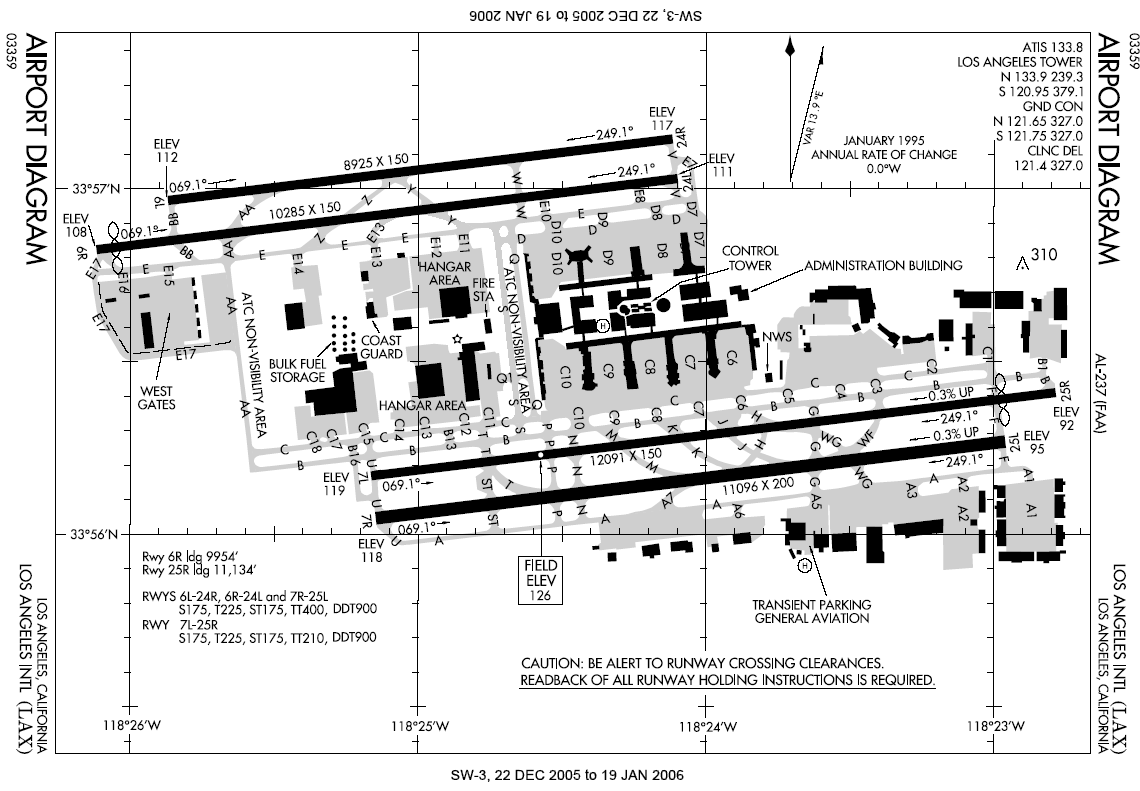
| Description | FAA diagram for Los Angeles International Airport (FAA: LAX, ICAO: KLAX) in Los Angeles, California, United States. |
| Date | 6 January 2006 |
| Source | http://naco.faa.gov/d-tpp/0512/00237AD.PDF (effective 22 DEC 2005 to 19 JAN 2006). Note: this URL changes monthly, see airport article's external links for a link to the current FAA diagram. |
| Author | National Aeronautical Charting Office (NACO), a department of the Federal Aviation Administration (FAA) in the United States. |
| Permission (Reusing this file) |
Public Domain |
Español: Mapa del Aeropuerto Internacional Los Ángeles.
Licensing edit
This image or file is a work of a Federal Aviation Administration employee, taken or made as part of that person's official duties. As a work of the U.S. federal government, the image is in the public domain in the United States.
|
 |
File history
Click on a date/time to view the file as it appeared at that time.
| Date/Time | Thumbnail | Dimensions | User | Comment | |
|---|---|---|---|---|---|
| current | 22:43, 6 January 2006 | | 1,140 × 791 (148 KB) | Cmprince (talk | contribs) | Aiport diagram for Los Angeles International Airport {{PD-USGov-FAA}} |
You cannot overwrite this file.
File usage on Commons
There are no pages that use this file.