File:LA districts map.svg

Size of this PNG preview of this SVG file: 429 × 599 pixels. Other resolutions: 172 × 240 pixels | 344 × 480 pixels | 550 × 768 pixels | 734 × 1,024 pixels | 1,467 × 2,048 pixels | 518 × 723 pixels.
Original file (SVG file, nominally 518 × 723 pixels, file size: 9.75 MB)
Captions
Captions
Add a one-line explanation of what this file represents
| Description |
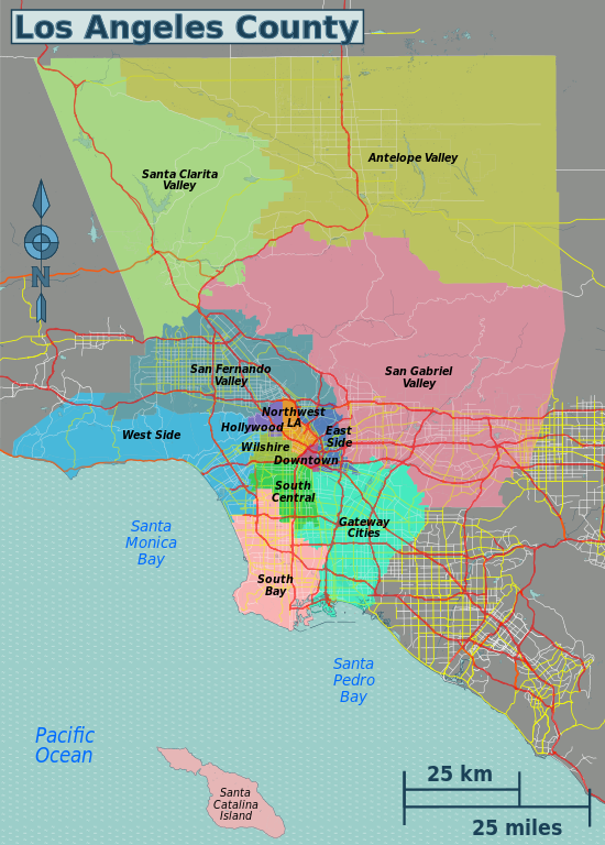
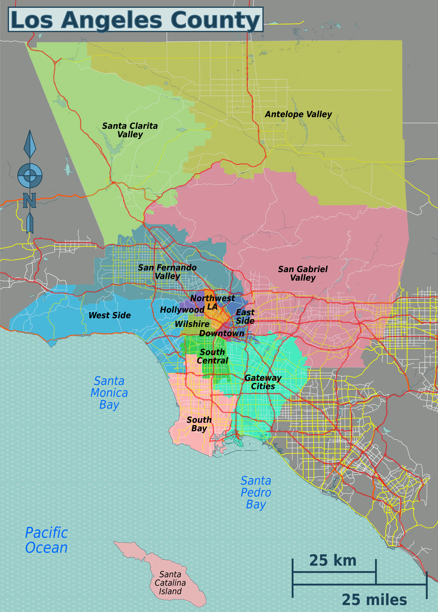
English: Map of Los Angeles County's travel districts. The Los Angeles Times' Mapping L.A. project created the individual neighborhood boundaries, but not the travel district groupings seen here. |
| Date | |
| Source | File:Mapping L.A. neighborhood boundaries.svg |
| Author | Peter Fitzgerald, OpenStreetMap; The Los Angeles Times' Mapping L.A. project created the individual neighborhood boundaries, but not the groupings seen here |
| Permission (Reusing this file) |
This file is licensed under the Creative Commons Attribution-Share Alike 2.0 Generic license.
|
| Other versions |
PNG files: |
File history
Click on a date/time to view the file as it appeared at that time.
| Date/Time | Thumbnail | Dimensions | User | Comment | |
|---|---|---|---|---|---|
| current | 20:46, 25 March 2016 | | 518 × 723 (9.75 MB) | PerryPlanet (talk | contribs) | Minor change |
| 18:50, 25 March 2016 |  | 518 × 723 (9.75 MB) | PerryPlanet (talk | contribs) | Updating to reflect a couple of district changes | |
| 22:50, 29 May 2013 |  | 518 × 723 (9.75 MB) | PerryPlanet (talk | contribs) | minor change in neighborhood layout | |
| 20:07, 21 May 2013 |  | 518 × 723 (9.74 MB) | Peterfitzgerald (talk | contribs) | {{Information |Description ={{en|1=Map of Los Angeles County's travel districts. The Los Angeles Times' [http://projects.latimes.com/mapping-la/about/ Mapping L.A. project] created the individual neighborhood boundaries, but not the travel district ... |
You cannot overwrite this file.
File usage on Commons
The following 4 pages use this file: